Podhradní Lhota | |
|---|---|
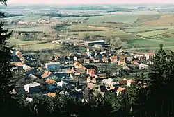 View from the south | |
 Flag  Coat of arms | |
 Podhradní Lhota Location in the Czech Republic | |
| Coordinates: 49°25′15″N 17°47′42″E / 49.42083°N 17.79500°E | |
| Country | |
| Region | Zlín |
| District | Kroměříž |
| First mentioned | 1271 |
| Area | |
| • Total | 3.81 km2 (1.47 sq mi) |
| Elevation | 386 m (1,266 ft) |
| Population (2023-01-01)[1] | |
| • Total | 460 |
| • Density | 120/km2 (310/sq mi) |
| Time zone | UTC+1 (CET) |
| • Summer (DST) | UTC+2 (CEST) |
| Postal code | 768 71 |
| Website | www |
Podhradní Lhota is a municipality and village in Kroměříž District in the Zlín Region of the Czech Republic. It has about 500 inhabitants.
Podhradní Lhota lies approximately 33 kilometres (21 mi) north-east of Kroměříž, 23 km (14 mi) north-east of Zlín, and 254 km (158 mi) east of Prague.
Sights
Ruins of the Nový Šaumburk castle is located in the municipality.
References
Wikimedia Commons has media related to Podhradní Lhota.
This article is issued from Wikipedia. The text is licensed under Creative Commons - Attribution - Sharealike. Additional terms may apply for the media files.