Žalkovice | |
|---|---|
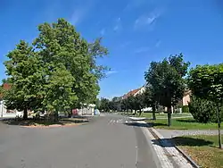 Centre of Žalkovice | |
 Flag  Coat of arms | |
 Žalkovice Location in the Czech Republic | |
| Coordinates: 49°22′19″N 17°26′9″E / 49.37194°N 17.43583°E | |
| Country | |
| Region | Zlín |
| District | Kroměříž |
| First mentioned | 1220 |
| Area | |
| • Total | 6.81 km2 (2.63 sq mi) |
| Elevation | 197 m (646 ft) |
| Population (2023-01-01)[1] | |
| • Total | 576 |
| • Density | 85/km2 (220/sq mi) |
| Time zone | UTC+1 (CET) |
| • Summer (DST) | UTC+2 (CEST) |
| Postal code | 768 23 |
| Website | www |
Žalkovice is a municipality and village in Kroměříž District in the Zlín Region of the Czech Republic. It has about 600 inhabitants.
Žalkovice lies approximately 9 kilometres (6 mi) north-east of Kroměříž, 23 km (14 mi) north-west of Zlín, and 232 km (144 mi) east of Prague.
References
Wikimedia Commons has media related to Žalkovice.
This article is issued from Wikipedia. The text is licensed under Creative Commons - Attribution - Sharealike. Additional terms may apply for the media files.