Palenque Municipality | |
|---|---|
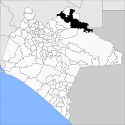 Location of the municipality in Sonora. | |
| Coordinates: 17°26′N 91°48′W / 17.433°N 91.800°W | |
| Country | |
| State | Chiapas |
| Municipal Seat | Palenque |
| Created | 1915 |
| Government | |
| • Municipal President | Jorge Cabrera Aguilar (2021—2024) |
| Area (2020)[1] | |
| • Total | 2,888 km2 (1,115 sq mi) |
| Elevation (Median) | 92 m (302 ft) |
| Population (2020) | |
| • Total | 132,265 |
| • Density | 45.8/km2 (119/sq mi) |
| Time zone | UTC-6 (Central (US Central)) |
| • Summer (DST) | UTC-5 (Central) |
| Postal code | 29960—29969 |
| Area code | 916 |
| Website | http://www.palenque.gob.mx/ |
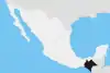
Palenque Municipality is a municipality in Chiapas in south Mexico.
Neighboring municipalities
Neighboring municipalities are Catazajá to the north, La Libertad to the east, Ocosingo and Chilón to the south, Salto de Agua to the west, and the other Mexican stat – Tabasco to the north and east, and country Guatemala to the southeast.[2]
Localities
There are 683 localities, the largest of which are:
| Code INEGI | Locality | Population |
| 065 | Total Municipality | 132,265 |
| 0001 | Palenque | 51,797 |
| 0105 | Río Chancalá | 2,236 |
| 0182 | Agua Blanca Serranía | 1,726 |
| 0047 | El Edén | 1,467 |
| 0191 | Arimatea | 1,385 |
References
This article is issued from Wikipedia. The text is licensed under Creative Commons - Attribution - Sharealike. Additional terms may apply for the media files.