Oradour | |
|---|---|
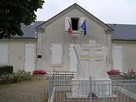 Town hall and war memorial | |
Location of Oradour | |
 Oradour 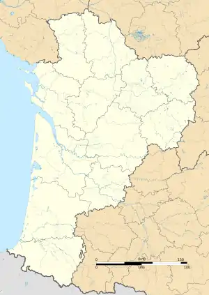 Oradour | |
| Coordinates: 45°54′27″N 0°01′50″W / 45.9075°N 0.0306°W | |
| Country | France |
| Region | Nouvelle-Aquitaine |
| Department | Charente |
| Arrondissement | Confolens |
| Canton | Charente-Nord |
| Intercommunality | Cœur de Charente |
| Government | |
| • Mayor (2020–2026) | Didier Lavergne[1] |
| Area 1 | 14.40 km2 (5.56 sq mi) |
| Population | 147 |
| • Density | 10/km2 (26/sq mi) |
| Time zone | UTC+01:00 (CET) |
| • Summer (DST) | UTC+02:00 (CEST) |
| INSEE/Postal code | 16248 /16140 |
| Elevation | 65–120 m (213–394 ft) (avg. 77 m or 253 ft) |
| 1 French Land Register data, which excludes lakes, ponds, glaciers > 1 km2 (0.386 sq mi or 247 acres) and river estuaries. | |
Oradour (French pronunciation: [ɔʁaduʁ]), commonly called Oradour-d'Aigre, is a commune in the Charente department in southwestern France.
Population
| Year | Pop. | ±% p.a. |
|---|---|---|
| 1968 | 296 | — |
| 1975 | 259 | −1.89% |
| 1982 | 250 | −0.50% |
| 1990 | 225 | −1.31% |
| 1999 | 200 | −1.30% |
| 2009 | 201 | +0.05% |
| 2014 | 183 | −1.86% |
| 2020 | 150 | −3.26% |
| Source: INSEE[3] | ||
See also
References
- ↑ "Répertoire national des élus: les maires" (in French). data.gouv.fr, Plateforme ouverte des données publiques françaises. 13 September 2022.
- ↑ "Populations légales 2021". The National Institute of Statistics and Economic Studies. 28 December 2023.
- ↑ Population en historique depuis 1968, INSEE
Wikimedia Commons has media related to Oradour (Charente).
This article is issued from Wikipedia. The text is licensed under Creative Commons - Attribution - Sharealike. Additional terms may apply for the media files.