
This is a list of the National Register of Historic Places listings in Allen County, Indiana.
This is intended to be a complete list of the properties and districts on the National Register of Historic Places in Allen County, Indiana, United States. Latitude and longitude coordinates are provided for many National Register properties and districts; these locations may be seen together in an online map.[1]
There are 74 properties and districts listed on the National Register in the county, including 2 National Historic Landmarks. Another 4 properties were once listed but have been removed.
Properties and districts located in incorporated areas display the name of the municipality, while properties and districts in unincorporated areas display the name of their civil township. Properties and districts split between multiple jurisdictions display the names of all jurisdictions.
This National Park Service list is complete through NPS recent listings posted January 12, 2024.[2]
Current listings
| [3] | Name on the Register[4] | Image | Date listed[5] | Location | City or town | Description |
|---|---|---|---|---|---|---|
| 1 | John H. and Mary Abercrombie House | 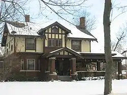 John H. and Mary Abercrombie House |
June 25, 2013 (#13000418) |
3130 Parnell Ave. 41°06′16″N 85°07′42″W / 41.104444°N 85.128333°W |
Fort Wayne | |
| 2 | Allen County Courthouse | 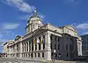 Allen County Courthouse |
May 28, 1976 (#76000031) |
715 S. Calhoun St. 41°04′47″N 85°08′22″W / 41.079724°N 85.139444°W |
Fort Wayne | |
| 3 | John H. Bass Mansion | 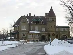 John H. Bass Mansion |
June 2, 1982 (#82000056) |
2701 Spring St. 41°05′15″N 85°10′33″W / 41.087500°N 85.175833°W |
Fort Wayne | |
| 4 | Becker House | November 17, 2022 (#100008406) |
425 West Williams St. 41°04′02″N 85°08′38″W / 41.0672°N 85.1438°W |
Fort Wayne | ||
| 5 | Beechwood Historic District | November 16, 2021 (#100007177) |
Roughly bounded by Fairfield and South Wayne Aves., Pierce and Beechwood Drs. 41°03′42″N 85°08′48″W / 41.0618°N 85.1467°W |
Fort Wayne | ||
| 6 | Blackstone Building | 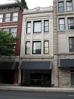 Blackstone Building |
August 24, 1988 (#88001219) |
112 W. Washington 41°04′22″N 85°08′01″W / 41.072778°N 85.133611°W |
Fort Wayne | |
| 7 | Martin Blume Jr. Farm | 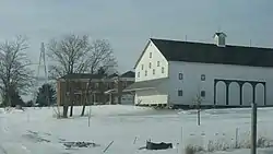 Martin Blume Jr. Farm |
September 20, 2006 (#06000847) |
7311 Flutter Rd., northeast of Fort Wayne 41°09′53″N 85°03′02″W / 41.164722°N 85.050556°W |
St. Joseph Township | |
| 8 | Brookview-Irvington Park Historic District | 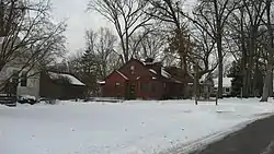 Brookview-Irvington Park Historic District |
March 21, 2011 (#11000121) |
Roughly bounded by Norfolk Ave. to the north, Lima Rd., Spy Run Ave. Extended, and N. Clinton St. to the east, Jacobs St. to the south, and the former Penn Central right-of-way to the west 41°06′04″N 85°08′27″W / 41.101111°N 85.140833°W |
Fort Wayne | |
| 9 | John Brown Stone Warehouse | 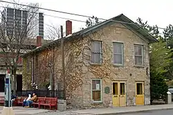 John Brown Stone Warehouse |
December 15, 1997 (#97001542) |
114 W. Superior St. 41°04′56″N 85°08′23″W / 41.082222°N 85.139722°W |
Fort Wayne | |
| 10 | Calvary United Brethren-Turner Chapel AME Church | February 9, 2022 (#100007447) |
836 East Jefferson Blvd. 41°04′40″N 85°07′35″W / 41.0778°N 85.1263°W |
Fort Wayne | ||
| 11 | Cathedral of the Immaculate Conception |  Cathedral of the Immaculate Conception |
October 23, 1980 (#80000048) |
Jefferson and Calhoun St. 41°04′33″N 85°08′16″W / 41.075833°N 85.137778°W |
Fort Wayne | |
| 12 | Chief Jean Baptiste de Richardville House | 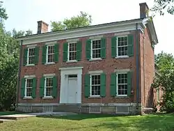 Chief Jean Baptiste de Richardville House |
June 27, 1997 (#97000595) |
5705 Bluffton Rd. 41°01′53″N 85°09′52″W / 41.031389°N 85.164444°W |
Fort Wayne | Designated a National Historic Landmark on March 2, 2012 as "Akima Pinsiwa Awiiki (Chief Jean-Baptiste de Richardville House)" |
| 13 | Coca-Cola Bottling Plant | August 23, 2021 (#100006841) |
1631 Pontiac St. 41°03′39″N 85°06′56″W / 41.0608°N 85.1155°W |
Fort Wayne vicinity | ||
| 14 | Colman-Doctor Farm | March 6, 2019 (#100003499) |
5910 Maples Rd. 41°00′14″N 85°03′45″W / 41.0040°N 85.0624°W |
Fort Wayne vicinity | ||
| 15 | Driving Park-Seven States Historic District | March 3, 2021 (#100006201) |
Roughly bounded by Vermont Ave., Crescent Ave. Florida Dr., State Blvd., West and East Drs., Curdes, and Dodge Aves. Ave 41°05′58″N 85°07′08″W / 41.0995°N 85.1190°W |
Fort Wayne | ||
| 16 | Dutch Ridge Historic District | 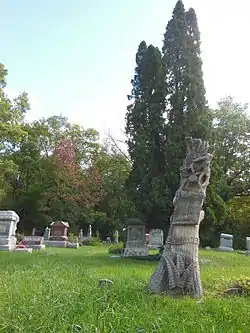 Dutch Ridge Historic District |
September 14, 1995 (#95001110) |
17915 and 17819 Old Auburn Rd. and adjacent cemetery, northeast of Huntertown 41°15′04″N 85°05′48″W / 41.2511°N 85.0967°W |
Perry Township | |
| 17 | William S. Edsall House | 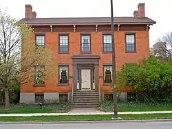 William S. Edsall House |
October 8, 1976 (#76000032) |
305 W. Main St. 41°04′46″N 85°08′38″W / 41.0794°N 85.1439°W |
Fort Wayne | |
| 18 | Embassy Theater and Indiana Hotel | 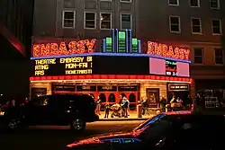 Embassy Theater and Indiana Hotel |
September 5, 1975 (#75000041) |
121 W. Jefferson St. 41°04′32″N 85°08′24″W / 41.0756°N 85.14°W |
Fort Wayne | |
| 19 | Engine House No. 3 | 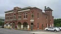 Engine House No. 3 |
July 27, 1979 (#79003772) |
226 W. Washington Boulevard 41°04′38″N 85°08′30″W / 41.0772°N 85.1417°W |
Fort Wayne | |
| 20 | Fairfield Manor | 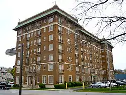 Fairfield Manor |
June 16, 1983 (#83000047) |
2301 Fairfield Ave. 41°03′50″N 85°08′41″W / 41.0639°N 85.1447°W |
Fort Wayne | |
| 21 | Robert M. Feustel House | 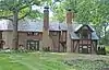 Robert M. Feustel House |
November 7, 1980 (#80000049) |
4101 W. Taylor St. 41°03′52″N 85°11′38″W / 41.0644°N 85.1939°W |
Fort Wayne | |
| 22 | Forest Park Boulevard Historic District | 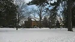 Forest Park Boulevard Historic District |
March 30, 2007 (#07000212) |
Roughly bounded by Dodge Ave., the alley between Forest Park and Anthony Boulevards, Lake Ave., and the alley 41°05′43″N 85°07′03″W / 41.0954°N 85.1175°W |
Fort Wayne | |
| 23 | Fort Wayne City Hall | 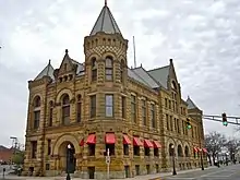 Fort Wayne City Hall |
June 4, 1973 (#73000027) |
308 E. Berry St. 41°04′46″N 85°08′10″W / 41.0794°N 85.1361°W |
Fort Wayne | |
| 24 | Fort Wayne Park and Boulevard System Historic District | 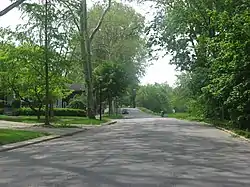 Fort Wayne Park and Boulevard System Historic District |
December 28, 2010 (#10001099) |
Roughly including the following parks and adjacent rights-of-way: Franke, McCormick, McCulloch, McMillen, Memorial, Nuckols, Old Fort, Reservoir, Rockhill, Weisser, and Williams 41°03′51″N 85°05′26″W / 41.064167°N 85.090556°W |
Fort Wayne | |
| 25 | Fort Wayne Printing Company Building | 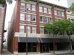 Fort Wayne Printing Company Building |
August 24, 1988 (#88001220) |
114 W. Washington St. 41°04′38″N 85°08′23″W / 41.077222°N 85.139722°W |
Fort Wayne | |
| 26 | Foster Park Neighborhood Historic District | 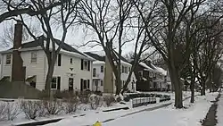 Foster Park Neighborhood Historic District |
September 25, 2013 (#13000755) |
Roughly bounded by Old Mill Rd., Rudisell Boulevard, Kimmel Dr., and Lexington Ave. 41°02′52″N 85°09′20″W / 41.047778°N 85.155556°W |
Fort Wayne | |
| 27 | General Electric Fort Wayne Electric Works Historic District | February 27, 2023 (#100008658) |
1635 Broadway and 1030 Swinney Ave. 41°04′17″N 85°08′56″W / 41.0714°N 85.1489°W |
Fort Wayne | ||
| 28 | William C. and Clara Hagerman House | 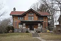 William C. and Clara Hagerman House |
March 17, 2015 (#15000076) |
2105 N. Anthony Boulevard 41°05′43″N 85°06′57″W / 41.095278°N 85.115833°W |
Fort Wayne | |
| 29 | Harrison Hill Historic District | August 25, 2021 (#100006844) |
Roughly bounded by West Rudisill Blvd., South Calhoun St., South Cornell Cir., Pasadena Dr., Hoagland Ave., and Webster St. 41°02′41″N 85°08′25″W / 41.0448°N 85.1404°W |
Fort Wayne | ||
| 30 | John and Dorothy Haynes House | 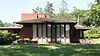 John and Dorothy Haynes House |
June 22, 2004 (#04000635) |
3901 N. Washington Rd.[6] 41°04′14″N 85°11′27″W / 41.070556°N 85.190833°W |
Fort Wayne | |
| 31 | Illsley Place-West Rudisill Historic District |  Illsley Place-West Rudisill Historic District |
April 20, 2006 (#06000310) |
Roughly bounded by Broadway, W. Rudisill Boulevard, Beaver Ave., and the alley north of Illsley Dr. 41°03′03″N 85°09′15″W / 41.050861°N 85.154167°W |
Fort Wayne | |
| 32 | Indian Village Historic District |  Indian Village Historic District |
December 22, 2009 (#09001125) |
Roughly bounded by Nuttman Ave. on the north, Bluffton Rd. on the east, Eagle Rd. on the south, and the Norfolk Southern railway line on the west 41°02′54″N 85°10′21″W / 41.048381°N 85.172472°W |
Fort Wayne | |
| 33 | Johnny Appleseed Memorial Park |  Johnny Appleseed Memorial Park |
January 17, 1973 (#73000028) |
Swanson Boulevard at Parnell Ave. along Old Feeder Canal 41°06′44″N 85°07′25″W / 41.112222°N 85.123611°W |
Fort Wayne | |
| 34 | Journal-Gazette Building | 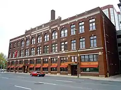 Journal-Gazette Building |
December 27, 1982 (#82000057) |
701 S. Clinton St. 41°04′49″N 85°08′17″W / 41.080278°N 85.138056°W |
Fort Wayne | |
| 35 | Kensington Boulevard Historic District |  Kensington Boulevard Historic District |
September 3, 2019 (#100004368) |
Roughly bounded by East State Blvd., North Anthony Blvd., Niagara Dr., and Pemberton Dr. 41°05′23″N 85°06′50″W / 41.0897°N 85.1138°W |
Fort Wayne | |
| 36 | Harry A. Keplinger House | 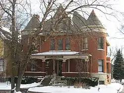 Harry A. Keplinger House |
September 1, 1983 (#83000048) |
235 W. Creighton Ave. 41°03′51″N 85°08′26″W / 41.064028°N 85.140417°W |
Fort Wayne | |
| 37 | Kresge-Groth Building | 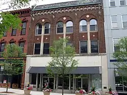 Kresge-Groth Building |
August 25, 1988 (#88001223) |
914 S. Calhoun St. 41°04′41″N 85°08′22″W / 41.078056°N 85.139444°W |
Fort Wayne | |
| 38 | Lafayette Place Historic District | 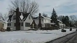 Lafayette Place Historic District |
January 9, 2013 (#12001147) |
Roughly bounded by S. Calhoun and Lafayette Sts., and McKinnie and Pettit Aves. 41°02′40″N 85°08′00″W / 41.044444°N 85.133333°W |
Fort Wayne | |
| 39 | Lakeside Historic District | 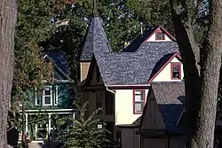 Lakeside Historic District |
December 8, 2017 (#100001879) |
Roughly bounded by St. Joe Blvd., Edgewater, Tennessee, Crescent & California Aves. 41°05′10″N 85°07′35″W / 41.086069°N 85.126426°W |
Fort Wayne | |
| 40 | The Landing Historic District | 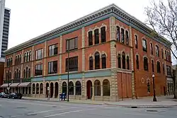 The Landing Historic District |
September 16, 1993 (#93000953) |
Roughly bounded by Calhoun, Harrison, Dock, and Pearl Sts., and the alley between Columbia and Main Sts. 41°04′52″N 85°08′29″W / 41.081111°N 85.141389°W |
Fort Wayne | |
| 41 | Lindenwood Cemetery | 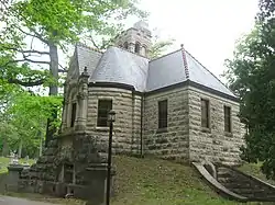 Lindenwood Cemetery |
February 17, 1978 (#78000043) |
2324 W. Main St. 41°04′47″N 85°10′32″W / 41.079722°N 85.175556°W |
Fort Wayne | |
| 42 | Masonic Temple | 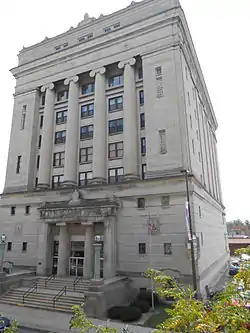 Masonic Temple |
March 14, 1991 (#91000273) |
206 E. Washington Boulevard 41°04′39″N 85°08′55″W / 41.0775°N 85.148611°W |
Fort Wayne | |
| 43 | McColloch-Weatherhogg Double House | 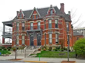 McColloch-Weatherhogg Double House |
December 7, 2001 (#01001350) |
334-336 E. Berry St. 41°04′54″N 85°08′07″W / 41.081667°N 85.135278°W |
Fort Wayne | |
| 44 | Hugh McCulloch House |  Hugh McCulloch House |
October 23, 1980 (#80000050) |
616 W. Superior St. 41°04′51″N 85°08′50″W / 41.080833°N 85.147222°W |
Fort Wayne | |
| 45 | Louis Mohr Block | 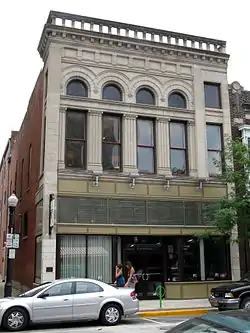 Louis Mohr Block |
August 26, 1988 (#88001222) |
119 W. Wayne St. 41°04′41″N 85°08′24″W / 41.078056°N 85.14°W |
Fort Wayne | |
| 46 | New York Chicago and St. Louis Railroad Steam Locomotive No. 765 | 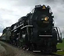 New York Chicago and St. Louis Railroad Steam Locomotive No. 765 |
September 12, 1996 (#96001010) |
15808 Edgerton Rd., east of New Haven 41°05′16″N 84°56′14″W / 41.0878°N 84.9372°W |
Jefferson Township | |
| 47 | Ninde-Mead-Farnsworth House | 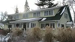 Ninde-Mead-Farnsworth House |
March 20, 2013 (#13000082) |
734 E. State Boulevard 41°05′47″N 85°07′49″W / 41.0964°N 85.1303°W |
Fort Wayne | |
| 48 | North Anthony Boulevard Historic District | 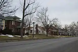 North Anthony Boulevard Historic District |
September 30, 2014 (#14000800) |
Roughly N. Anthony Boulevard between Vance and Lake Aves. 41°06′00″N 85°06′56″W / 41.1000°N 85.1156°W |
Fort Wayne | |
| 49 | Oakdale Historic District | 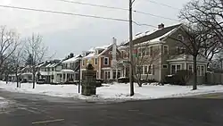 Oakdale Historic District |
September 22, 2000 (#00001132) |
Roughly along Oakdale Dr. from Harrison St. to Broadway 41°03′06″N 85°08′52″W / 41.0517°N 85.1478°W |
Fort Wayne | |
| 50 | Pennsylvania Railroad Station | 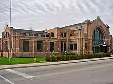 Pennsylvania Railroad Station |
August 14, 1998 (#98001056) |
221 W. Baker St. 41°04′20″N 85°08′26″W / 41.0722°N 85.1406°W |
Fort Wayne | |
| 51 | John Claus Peters House | 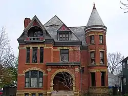 John Claus Peters House |
September 17, 1980 (#80000051) |
832 W. Wayne St. 41°04′36″N 85°09′03″W / 41.0767°N 85.1508°W |
Fort Wayne | |
| 52 | Randall Building | 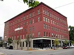 Randall Building |
December 7, 1990 (#90001786) |
616 and 618 S. Harrison St. 41°04′52″N 85°08′33″W / 41.0811°N 85.1425°W |
Fort Wayne | |
| 53 | Alexander Taylor Rankin House | 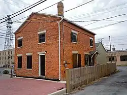 Alexander Taylor Rankin House |
December 6, 2004 (#04001317) |
818 S. Lafayette St. 41°04′53″N 85°08′05″W / 41.0814°N 85.1347°W |
Fort Wayne | |
| 54 | Horney Robinson House | 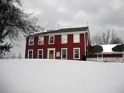 Horney Robinson House |
March 21, 1985 (#85000604) |
7320 Lower Huntington Rd., southwest of Fort Wayne 41°00′19″N 85°14′13″W / 41.0053°N 85.2369°W |
Wayne Township | |
| 55 | St. Louis, Besancon, Historic District | 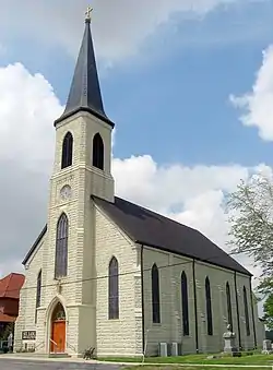 St. Louis, Besancon, Historic District |
September 22, 1995 (#95001112) |
15529-15535 E. Lincoln Highway, southeast of New Haven 41°03′03″N 84°56′15″W / 41.0508°N 84.9375°W |
Jefferson Township | |
| 56 | Saint Paul's Evangelical Lutheran Church | 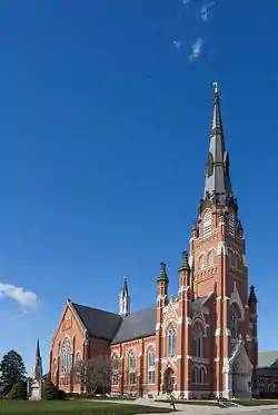 Saint Paul's Evangelical Lutheran Church |
March 1, 1982 (#82000058) |
1126 S. Barr St. 41°04′32″N 85°08′08″W / 41.0756°N 85.1356°W |
Fort Wayne | |
| 57 | St. Peter's Square | 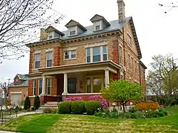 St. Peter's Square |
March 20, 1991 (#91000259) |
Roughly bounded by St. Martin, Hanna, E. Dewald, and Warsaw Sts., including 518 E. Dewald St. 41°03′56″N 85°07′46″W / 41.0656°N 85.1294°W |
Fort Wayne | |
| 58 | St. Rose de Lima Roman Catholic Church and Rectory | August 27, 2020 (#100005514) |
209 Mulberry St. and 206 Summit St. 40°58′20″N 84°52′05″W / 40.9721°N 84.8681°W |
Monroeville | ||
| 59 | St. Vincent Villa Historic District | 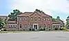 St. Vincent Villa Historic District |
June 10, 1994 (#94000587) |
2000 N. Wells St. 41°05′35″N 85°08′39″W / 41.0931°N 85.1442°W |
Fort Wayne | |
| 60 | Schmitz Block | 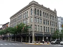 Schmitz Block |
August 26, 1988 (#88001224) |
926-930 S. Calhoun St. 41°04′39″N 85°08′21″W / 41.0775°N 85.1392°W |
Fort Wayne | |
| 61 | Smith Field | 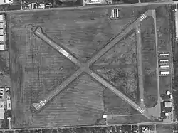 Smith Field |
March 26, 2003 (#02001495) |
426 W. Ludwig Rd. 41°08′36″N 85°09′10″W / 41.1433°N 85.1528°W |
Fort Wayne | |
| 62 | South Wayne Historic District | 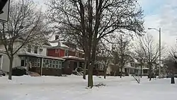 South Wayne Historic District |
September 4, 1992 (#92001146) |
Roughly bounded by W. Wildwood Ave., S. Wayne Ave., Packard Ave., and Beaver Ave. 41°03′22″N 85°08′59″W / 41.0561°N 85.1497°W |
Fort Wayne | |
| 63 | Southwood Park Historic District | 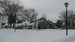 Southwood Park Historic District |
December 22, 2009 (#09001126) |
Bounded by W. Pettit Ave., Stratford Rd., W. Sherwood Terrace, Hartman Rd., Lexington Ave., and Indiana Ave. 41°02′32″N 85°08′57″W / 41.0421°N 85.1492°W |
Fort Wayne | |
| 64 | Christian G. Strunz House |  Christian G. Strunz House |
October 4, 1979 (#79000030) |
333 E. Berry St. 41°04′49″N 85°08′07″W / 41.0803°N 85.1353°W |
Fort Wayne | |
| 65 | Thomas W. Swinney House | 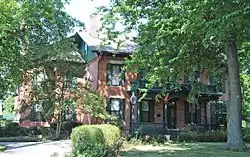 Thomas W. Swinney House |
April 27, 1981 (#81000026) |
1424 W. Jefferson St. 41°04′24″N 85°09′27″W / 41.0733°N 85.1575°W |
Fort Wayne | |
| 66 | Trinity Episcopal Church |  Trinity Episcopal Church |
September 13, 1978 (#78000044) |
611 W. Berry St. 41°04′40″N 85°08′52″W / 41.0778°N 85.1478°W |
Fort Wayne | |
| 67 | US Post Office and Courthouse | 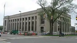 US Post Office and Courthouse |
March 15, 2006 (#06000125) |
1300 W. Harrison St. 41°04′26″N 85°08′26″W / 41.0739°N 85.1406°W |
Fort Wayne | |
| 68 | Vermilyea Inn Historic District | 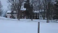 Vermilyea Inn Historic District |
December 6, 2005 (#05001365) |
13501 Redding Dr., southwest of Fort Wayne 41°00′46″N 85°19′04″W / 41.0128°N 85.3178°W |
Aboite Township | |
| 69 | Wabash Railroad Depot | 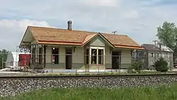 Wabash Railroad Depot |
March 26, 2003 (#03000146) |
530 State St. 41°04′18″N 85°01′20″W / 41.0717°N 85.0222°W |
New Haven | |
| 70 | Wells Street Bridge | 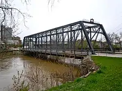 Wells Street Bridge |
September 15, 1988 (#88001575) |
Wells St. at the St. Marys River 41°05′13″N 85°08′27″W / 41.0869°N 85.1408°W |
Fort Wayne | |
| 71 | West End Historic District | 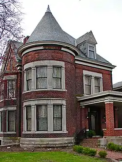 West End Historic District |
November 15, 1984 (#84000352) |
Roughly bounded by Main, Webster, Jefferson, Broadway, Jones, and the St. Marys River 41°04′32″N 85°08′59″W / 41.0756°N 85.1497°W |
Fort Wayne | |
| 72 | Fisher West Farm | 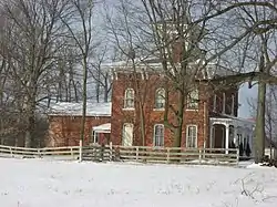 Fisher West Farm |
June 6, 1985 (#85001193) |
17935 West Rd., northeast of Huntertown 41°15′05″N 85°09′11″W / 41.2514°N 85.1531°W |
Perry Township | |
| 73 | Wildwood Park Historic District | 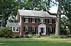 Wildwood Park Historic District |
September 18, 2013 (#13000720) |
Roughly bounded by Freeman St., Illinois Rd., W. Jefferson and Portage Boulevards, and Lindenwood and Ardmore Aves. 41°04′16″N 85°11′10″W / 41.0711°N 85.1861°W |
Fort Wayne | |
| 74 | Williams–Woodland Park Historic District | 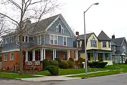 Williams–Woodland Park Historic District |
March 14, 1991 (#91000258) |
Roughly bounded by Hoagland and Creighton Aves. and Harrison and Pontiac Sts. 41°03′45″N 85°08′28″W / 41.0625°N 85.1411°W |
Fort Wayne |
Former listings
| [3] | Name on the Register | Image | Date listed | Date removed | Location | City or town | Description |
|---|---|---|---|---|---|---|---|
| 1 | Irene Byron Tuberculosis Sanatorium-Physicians' Residences | 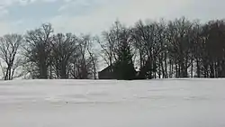 Irene Byron Tuberculosis Sanatorium-Physicians' Residences |
December 6, 2004 (#04001316) | December 31, 2013 | 12371 and 12407 Lima Rd., north of Fort Wayne 41°11′48″N 85°10′12″W / 41.196667°N 85.170028°W |
Perry Township | |
| 2 | Craigville Depot | 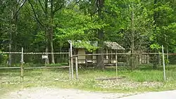 Craigville Depot |
October 10, 1984 (#84000181) | February 22, 2023 | Ryan and Edgerton Rds., east of New Haven 41°04′45″N 84°57′42″W / 41.079167°N 84.961667°W |
Jefferson Township | |
| 3 | Hursh Road Bridge (Bridge Number 38) | June 4, 1981 (#81000025) | May 25, 1993 | West of Cedarville on Hursh Road 41°12′55″N 85°03′05″W / 41.215278°N 85.051389°W |
Cedarville | ||
| 4 | St. Mary's Catholic Church | 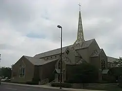 St. Mary's Catholic Church |
December 27, 1984 (#84000483) | September 13, 1993 | 1101 S. Lafayette St. 41°04′36″N 85°08′00″W / 41.076667°N 85.133333°W |
Fort Wayne | Destroyed by fire September 2, 1993 after being struck by lightning.[7] |
See also
References
- ↑ The latitude and longitude information provided in this table was derived originally from the National Register Information System, which has been found to be fairly accurate for about 99% of listings. Some locations in this table may have been corrected to current GPS standards.
- ↑ National Park Service, United States Department of the Interior, "National Register of Historic Places: Weekly List Actions", retrieved January 12, 2024.
- 1 2 Numbers represent an alphabetical ordering by significant words. Various colorings, defined here, differentiate National Historic Landmarks and historic districts from other NRHP buildings, structures, sites or objects.
- ↑ "National Register Information System". National Register of Historic Places. National Park Service. March 13, 2009.
- ↑ The eight-digit number below each date is the number assigned to each location in the National Register Information System database, which can be viewed by clicking the number.
- ↑ Location derived from page 3 of the minutes of the April 2004 meeting of the Indiana Historic Preservation Review Board; the NRIS lists the site as "Address Restricted".
- ↑ Fort Wayne Homepage
| Topics | |
|---|---|
| Lists by state |
|
| Lists by insular areas | |
| Lists by associated state | |
| Other areas | |
| Related | |

Municipalities and communities of Allen County, Indiana, United States | ||
|---|---|---|
| Cities | Map of Indiana highlighting Allen County | |
| Towns | ||
| Townships | ||
| CDPs | ||
| Other communities | ||
| Footnotes | ‡This populated place also has portions in an adjacent county or counties | |