Mohr County
Persian: شهرستان مُهر | |
|---|---|
County | |
.svg.png.webp) Location of Mohr County in Fars province | |
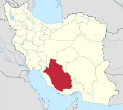 Location of Fars province in Iran | |
| Coordinates: 27°43′N 52°44′E / 27.717°N 52.733°E[1] | |
| Country | |
| Province | Fars |
| Capital | Mohr |
| Districts | Central, Asir, Galleh Dar, Varavi |
| Population (2016)[2] | |
| • Total | 64,827 |
| Time zone | UTC+3:30 (IRST) |
| Mohr County can be found at GEOnet Names Server, at this link, by opening the Advanced Search box, entering "9206575" in the "Unique Feature Id" form, and clicking on "Search Database". | |
Mohr County (Persian: شهرستان مُهر) is in Fars province, Iran. Its capital is the city of Mohr.[3]
At the 2006 census, the county's population was 54,094 in 10,999 households.[4] The following census in 2011 counted 59,727 people in 14,083 households.[5] At the 2016 census, the county's population was 64,827 in 17,262 households.[2]
The county's main industries are based on its rich gas sources. Tabnak, Homa, Shanol, Varavi and Parsian refineries are important gas zones in this region. The climate is hot and dry.
Administrative divisions
The population history and structural changes of Mohr County's administrative divisions over three consecutive censuses are shown in the following table. The latest census shows four districts, eight rural districts, and five cities.[2]
| Administrative Divisions | 2006[4] | 2011[5] | 2016[2] |
|---|---|---|---|
| Central District | 13,265 | 15,213 | 15,386 |
| Arudan RD | 4,372 | 4,942 | 5,012 |
| Mohr RD | 2,705 | 2,448 | 2,590 |
| Mohr (city) | 6,188 | 7,823 | 7,784 |
| Asir District | 13,024 | 11,195 | 14,003 |
| Asir RD | 8,553 | 4,691 | 5,818 |
| Dasht-e Laleh RD | 4,471 | 4,324 | 5,143 |
| Asir (city) | 2,180 | 3,042 | |
| Galleh Dar District | 16,194 | 19,992 | 22,554 |
| Fal RD | 5,869 | 6,514 | 6,538 |
| Galleh Dar RD | 343 | 2,124 | 2,568 |
| Fal (city)1 | |||
| Galleh Dar (city) | 9,982 | 11,354 | 13,448 |
| Varavi District | 11,611 | 13,065 | 12,884 |
| Khuzi RD | 4,092 | 5,585 | 1,837 |
| Varavi RD | 3,463 | 3,509 | 3,180 |
| Khuzi (city) | 3,245 | ||
| Varavi (city) | 4,056 | 3,971 | 4,622 |
| Total | 54,094 | 59,727 | 64,827 |
| RD: Rural District 1Became a city after the 2016 census[6] | |||
References
- ↑ OpenStreetMap contributors (27 September 2023). "Mohr County" (Map). OpenStreetMap. Retrieved 27 September 2023.
- 1 2 3 4 "Census of the Islamic Republic of Iran, 1395 (2016)". AMAR (in Persian). The Statistical Center of Iran. p. 07. Archived from the original (Excel) on 6 April 2022. Retrieved 19 December 2022.
- ↑ Aref, Mohammad Reza. "Approval letter regarding the changes and reforms of divisions in Fars province". Islamic Council Research Center (in Persian). Ministry of Interior, Council of Ministers. Archived from the original on 9 October 2021. Retrieved 10 December 2023.
- 1 2 "Census of the Islamic Republic of Iran, 1385 (2006)". AMAR (in Persian). The Statistical Center of Iran. p. 07. Archived from the original (Excel) on 20 September 2011. Retrieved 25 September 2022.
- 1 2 "Census of the Islamic Republic of Iran, 1390 (2011)". Syracuse University (in Persian). The Statistical Center of Iran. p. 07. Archived from the original (Excel) on 16 January 2023. Retrieved 19 December 2022.
- ↑ "With the approval of the Minister of Interior, the city of Fal from Mohr County will become the owner of a municipality". Fars News (in Persian). Ministry of Interior. 9 December 2019. Archived from the original on 27 September 2023. Retrieved 27 September 2023.

| Capital | |||||||||||||||||||||||||||||||||||||||||
|---|---|---|---|---|---|---|---|---|---|---|---|---|---|---|---|---|---|---|---|---|---|---|---|---|---|---|---|---|---|---|---|---|---|---|---|---|---|---|---|---|---|
| Districts |
| ||||||||||||||||||||||||||||||||||||||||