Bavanat County
Persian: شهرستان بوانات | |
|---|---|
County | |
.svg.png.webp) Location of Bavanat County in Fars province | |
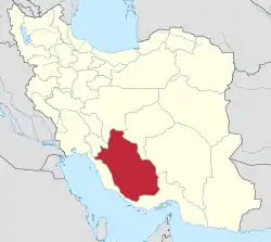 Location of Fars province in Iran | |
| Coordinates: 30°27′N 53°31′E / 30.450°N 53.517°E[1] | |
| Country | |
| Province | Fars |
| Capital | Bavanat |
| Districts | Central, Mazayjan |
| Population (2016)[2] | |
| • Total | 50,418 |
| Time zone | UTC+3:30 (IRST) |
| Bavanat County can be found at GEOnet Names Server, at this link, by opening the Advanced Search box, entering "9206469" in the "Unique Feature Id" form, and clicking on "Search Database". | |
Bavanat County (Persian: شهرستان بوانات) is in Fars province, Iran. Its capital is the city of Bavanat.
At the 2006 census, the county's population was 44,069 in 11,341 households.[3] The following census in 2011 counted 48,416 people in 13,636 households.[4] At the 2016 census, the county's population was 50,418 in 15,874 households.[2]
Administrative divisions
The population history and structural changes of Bavanat County's administrative divisions over three consecutive censuses are shown in the following table. The latest census shows three districts, seven rural districts, and four cities.[2]
In 2018, Sarchehan District was separated from the county in the establishment of Sarchehan County, which was divided into three districts of two rural districts each.[5]
| Administrative Divisions | 2006[3] | 2011[4] | 2016[2] |
|---|---|---|---|
| Central District | 25,136 | 16,442 | 16,698 |
| Baghestan RD | 4,200 | 3,913 | 4,410 |
| Mazayjan RD | 5,440 | ||
| Sarvestan RD | 3,804 | ||
| Simakan RD | 2,047 | 1,859 | 2,512 |
| Bavanat (city) | 9,645 | 10,670 | 9,776 |
| Mazayjan District | 8,974 | 10,591 | |
| Mazayjan RD | 5,251 | 2,985 | |
| Sarvestan RD | 3,723 | 4,039 | |
| Mazayjan (city) | 3,567 | ||
| Sarchehan District1 | 18,933 | 22,492 | 23,129 |
| Bagh Safa RD | 4,432 | 5,203 | 5,004 |
| Sarchehan RD | 5,002 | 2,925 | 3,703 |
| Tujerdi RD | 6,341 | 7,626 | 7,337 |
| Hesami (city) | 2,826 | 3,131 | |
| Korehi (city) | 3,158 | 3,912 | 3,954 |
| Total | 44,069 | 48,416 | 50,418 |
| RD: Rural District 1Became a part of Sarchehan County after the 2016 census[5] | |||
Wikimedia Commons has media related to Bavanat County.
References
- ↑ OpenStreetMap contributors (14 September 2023). "Bavanat County" (Map). OpenStreetMap. Retrieved 14 September 2023.
- 1 2 3 4 "Census of the Islamic Republic of Iran, 1395 (2016)". AMAR (in Persian). The Statistical Center of Iran. p. 07. Archived from the original (Excel) on 6 April 2022. Retrieved 19 December 2022.
- 1 2 "Census of the Islamic Republic of Iran, 1385 (2006)". AMAR (in Persian). The Statistical Center of Iran. p. 07. Archived from the original (Excel) on 20 September 2011. Retrieved 25 September 2022.
- 1 2 "Census of the Islamic Republic of Iran, 1390 (2011)". Syracuse University (in Persian). The Statistical Center of Iran. p. 07. Archived from the original (Excel) on 16 January 2023. Retrieved 19 December 2022.
- 1 2 Jahangiri, Ishaq (10 July 2018). "Letter of approval regarding the country divisions of Bavanat County, Fars province". Qavanin (in Persian). Ministry of Interior, Board of Ministers. Archived from the original on 15 September 2023. Retrieved 15 September 2023.

| Capital | |||||||||||||||||||||||||||
|---|---|---|---|---|---|---|---|---|---|---|---|---|---|---|---|---|---|---|---|---|---|---|---|---|---|---|---|
| Districts |
| ||||||||||||||||||||||||||
This article is issued from Wikipedia. The text is licensed under Creative Commons - Attribution - Sharealike. Additional terms may apply for the media files.