Mittainvilliers-Vérigny | |
|---|---|
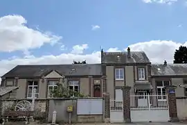 The town hall and school in Mittainvilliers-Vérigny | |
Location of Mittainvilliers-Vérigny | |
 Mittainvilliers-Vérigny 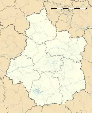 Mittainvilliers-Vérigny | |
| Coordinates: 48°29′56″N 1°18′36″E / 48.499°N 1.310°E | |
| Country | France |
| Region | Centre-Val de Loire |
| Department | Eure-et-Loir |
| Arrondissement | Chartres |
| Canton | Illiers-Combray |
| Intercommunality | CA Chartres Métropole |
| Government | |
| • Mayor (2020–2026) | Mickaël Tachat[1] |
| Area 1 | 24.76 km2 (9.56 sq mi) |
| Population | 799 |
| • Density | 32/km2 (84/sq mi) |
| Time zone | UTC+01:00 (CET) |
| • Summer (DST) | UTC+02:00 (CEST) |
| INSEE/Postal code | 28254 /28190 |
| 1 French Land Register data, which excludes lakes, ponds, glaciers > 1 km2 (0.386 sq mi or 247 acres) and river estuaries. | |
Mittainvilliers-Vérigny (French pronunciation: [mitɛ̃vilje veʁiɲi]) is a commune in the Eure-et-Loir department of northern France. The municipality was established on 1 January 2016 by merger of the former communes of Mittainvilliers and Vérigny.[3]
See also
References
Wikimedia Commons has media related to Mittainvilliers-Vérigny.
- ↑ "Répertoire national des élus: les maires" (in French). data.gouv.fr, Plateforme ouverte des données publiques françaises. 13 September 2022.
- ↑ "Populations légales 2021". The National Institute of Statistics and Economic Studies. 28 December 2023.
- ↑ Arrêté préfectoral 30 September 2015 (in French)
This article is issued from Wikipedia. The text is licensed under Creative Commons - Attribution - Sharealike. Additional terms may apply for the media files.