Levainville | |
|---|---|
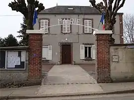 The town hall in Levainville | |
 Coat of arms | |
Location of Levainville | |
 Levainville 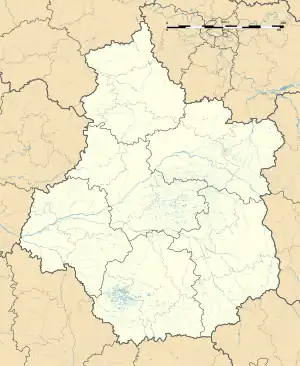 Levainville | |
| Coordinates: 48°29′23″N 1°44′36″E / 48.4896°N 1.7434°E | |
| Country | France |
| Region | Centre-Val de Loire |
| Department | Eure-et-Loir |
| Arrondissement | Chartres |
| Canton | Auneau |
| Intercommunality | CC des Portes Euréliennes d'Île-de-France |
| Government | |
| • Mayor (2020–2026) | Michel Darrivère[1] |
| Area 1 | 5.55 km2 (2.14 sq mi) |
| Population | 377 |
| • Density | 68/km2 (180/sq mi) |
| Time zone | UTC+01:00 (CET) |
| • Summer (DST) | UTC+02:00 (CEST) |
| INSEE/Postal code | 28208 /28700 |
| Elevation | 117–156 m (384–512 ft) (avg. 130 m or 430 ft) |
| 1 French Land Register data, which excludes lakes, ponds, glaciers > 1 km2 (0.386 sq mi or 247 acres) and river estuaries. | |
Levainville (French pronunciation: [ləvɛ̃vil]) is a commune in the Eure-et-Loir department and Centre-Val de Loire region of north-central France. It lies 19 km east of Chartres and some 60 km south-west of Paris.
Population
| Year | Pop. | ±% p.a. |
|---|---|---|
| 1968 | 158 | — |
| 1975 | 172 | +1.22% |
| 1982 | 202 | +2.32% |
| 1990 | 264 | +3.40% |
| 1999 | 292 | +1.13% |
| 2009 | 396 | +3.09% |
| 2014 | 395 | −0.05% |
| 2020 | 378 | −0.73% |
| Source: INSEE[3] | ||
See also
References
- ↑ "Répertoire national des élus: les maires". data.gouv.fr, Plateforme ouverte des données publiques françaises (in French). 2 December 2020.
- ↑ "Populations légales 2021". The National Institute of Statistics and Economic Studies. 28 December 2023.
- ↑ Population en historique depuis 1968, INSEE
Wikimedia Commons has media related to Levainville.
This article is issued from Wikipedia. The text is licensed under Creative Commons - Attribution - Sharealike. Additional terms may apply for the media files.