Mesnil-Raoul | |
|---|---|
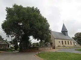 The church in Mesnil-Raoul | |
.svg.png.webp) Coat of arms | |
Location of Mesnil-Raoul | |
 Mesnil-Raoul  Mesnil-Raoul | |
| Coordinates: 49°23′51″N 1°16′31″E / 49.3975°N 1.2753°E | |
| Country | France |
| Region | Normandy |
| Department | Seine-Maritime |
| Arrondissement | Rouen |
| Canton | Le Mesnil-Esnard |
| Government | |
| • Mayor (2020–2026) | Emmanuel Gosse[1] |
| Area 1 | 6.76 km2 (2.61 sq mi) |
| Population | 1,171 |
| • Density | 170/km2 (450/sq mi) |
| Time zone | UTC+01:00 (CET) |
| • Summer (DST) | UTC+02:00 (CEST) |
| INSEE/Postal code | 76434 /76520 |
| Elevation | 126–162 m (413–531 ft) (avg. 150 m or 490 ft) |
| 1 French Land Register data, which excludes lakes, ponds, glaciers > 1 km2 (0.386 sq mi or 247 acres) and river estuaries. | |
Mesnil-Raoul is a commune in the Seine-Maritime department in the Normandy region in northern France.
Geography
A farming village, situated by the border with the department of Eure, some 12 miles (19 km) southeast of Rouen at the junction of the D13, D294 and the D6014 roads.
Population
| Year | Pop. | ±% p.a. |
|---|---|---|
| 1968 | 353 | — |
| 1975 | 400 | +1.80% |
| 1982 | 475 | +2.49% |
| 1990 | 689 | +4.76% |
| 1999 | 725 | +0.57% |
| 2007 | 835 | +1.78% |
| 2012 | 895 | +1.40% |
| 2017 | 1,024 | +2.73% |
| Source: INSEE[3] | ||
Places of interest
- The church of St.Jean, dating from the eleventh century.
- The museum of music.
See also
References
- ↑ Liste des maires du département de la Seine-Maritime, 10 August 2020
- ↑ "Populations légales 2021". The National Institute of Statistics and Economic Studies. 28 December 2023.
- ↑ Population en historique depuis 1968, INSEE
Wikimedia Commons has media related to Mesnil-Raoul.
This article is issued from Wikipedia. The text is licensed under Creative Commons - Attribution - Sharealike. Additional terms may apply for the media files.