La Torre de Fontaubella | |
|---|---|
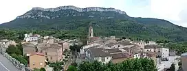 North face of Mola de Colldejou rising above La Torre de Fontaubella | |
 Flag  Coat of arms | |
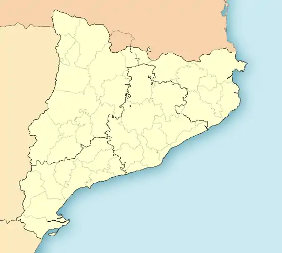 La Torre de Fontaubella Location in Catalonia | |
| Coordinates: 41°07′34″N 0°51′56″E / 41.12611°N 0.86556°E | |
| Country | |
| Community | |
| Province | Tarragona |
| Comarca | Priorat |
| Government | |
| • Mayor | Jaume Rofes Anglés (2015)[1] |
| Area | |
| • Total | 7.1 km2 (2.7 sq mi) |
| Elevation | 369 m (1,211 ft) |
| Population (2018)[3] | |
| • Total | 137 |
| • Density | 19/km2 (50/sq mi) |
| Demonym(s) | Torretà, Torretana |
| Website | www |
La Torre de Fontaubella is a municipality in the comarca of the Priorat in Catalonia, Spain. It is situated at the southeastern end of the comarca.
Demography
| 1900 | 1930 | 1950 | 1970 | 1986 | 2007 |
|---|---|---|---|---|---|
| 255 | 156 | 135 | 114 | n/a | 147 |
References
- ↑ "Ajuntament de la Torre de Fontaubella". Generalitat of Catalonia. Retrieved 2015-11-13.
- ↑ "El municipi en xifres: La Torre de Fontaubella". Statistical Institute of Catalonia. Retrieved 2015-11-23.
- ↑ Municipal Register of Spain 2018. National Statistics Institute.
External links
Wikimedia Commons has media related to La Torre de Fontaubella.
- Official municipal website
- Government data pages (in Catalan)
Places adjacent to La Torre de Fontaubella | ||||||||||||||||
|---|---|---|---|---|---|---|---|---|---|---|---|---|---|---|---|---|
| ||||||||||||||||

This article is issued from Wikipedia. The text is licensed under Creative Commons - Attribution - Sharealike. Additional terms may apply for the media files.