Khiron
Khīron | |
|---|---|
Village | |
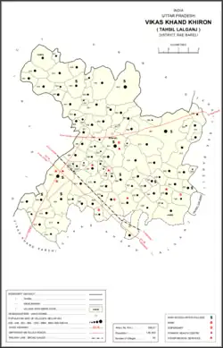 Map of Khiron CD block | |
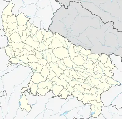 Khiron Location in Uttar Pradesh, India | |
| Coordinates: 26°17′14″N 80°55′26″E / 26.2871°N 80.9239°E[1] | |
| Country | India |
| State | Uttar Pradesh |
| District | Raebareli |
| Area | |
| • Total | 7.717 km2 (2.980 sq mi) |
| Population (2011)[2] | |
| • Total | 9,955 |
| • Density | 1,300/km2 (3,300/sq mi) |
| Languages | |
| • Official | Hindi |
| Time zone | UTC+5:30 (IST) |
| Vehicle registration | UP-33 |
Khiron is a village and corresponding community development block in Rae Bareli district, Uttar Pradesh, India.[2] Located on the main Raebareli-Unnao road, Khiron is an old Muslim town that historically served as the seat of a pargana.[3] As of 2011, the village has a population of 9,955, in 1,714 households.[2] It has six primary schools and one medical clinic.[2] It serves as the headquarters of a nyaya panchayat that also includes 11 other villages.[4]
Khiron hosts an annual mela at the Balbhadreshwar Mahadeo temple[3] on Phalguna Badi 13; the festival is part of Shivratri and is dedicated to the worship of Shiva.[5] Vendors bring various everyday items to sell at the fair.[5] Khiron also hosts markets twice per week, on Mondays and Thursdays; the main items traded are cloth and vegetables.[5]
History
Khiron was fortified and made the seat of a pargana during the reign of Asaf-ud-Daula; the headquarters had previously been at Satanpur since its foundation and fortification by the Bais raja Sathna.[3] Khiron was also historically the seat of a taluqdari estate belonging to a Janwar dynasty, and there were also several Kayasth qanungo families, including many descended from Rai Sahib Rai, who had been a chakladar under the Nawabs of Awadh.[3] Rai Sahib Rai had built a fort at Khiron whose ruins still exist.[3] There is also the tomb of Fateh Shahid, a companion of the Muslim folk hero Sayyid Salar Masud.[3]
The population of Khiron declined sharply in the late 1800s from 3,408 in 1869 to 2,669 in 1901.[3] At the 1901 census, there were 559 Muslims, almost entirely Pathans.[3] Turn-of-the-century Khiron had a large primary school, a cattle pound, a branch post office, and two bazars called Balbhaddarganj and Raghunathganj, holding markets twice per week.[3] There was a large tank to the north and east of the town, as well as some kankar quarries and plenty of orchards.[3]
The 1951 census recorded Khiron as comprising 10 hamlets, with a total population of 2,939 people (1,474 male and 1,465 female), in 593 households and 593 physical houses.[6] The area of the village was given as 1,925 acres (779 ha)s.[6] 338 residents were literate, 295 male and 43 female.[6] The village was listed as belonging to the pargana of Khiron and the thana of Gurbakshganj.[6]
The 1961 census recorded Khiron as comprising 10 hamlets, with a total population of 3,210 people (1,679 male and 1,531 female), in 590 households and 536 physical houses.[5] The area of the village was given as 1,925 acres (779 ha)s and it had a post office at that point.[5] There was a dispensary run by a local body with five male beds and one female bed; It had one grain mill, and four small manufacturers of clothing.[5] Average attendance of market was 500 and for the festival it was 400.[5]
The 1981 census recorded Khiron as having a population of 5,243 people, in 946 households, and having an area of 973.76 hectares (2,406.2 acres).[7] The main staple foods were listed as wheat and rice.[7]
The 1991 census recorded Khiron as having a total population of 6,296 people (3,317 male and 2,979 female), in 1,127 households and 1,124 physical houses.[4] The area of the village was listed as 57 hectares (140 acres).[4] Members of the 0-6 age group numbered 1,262, or 20% of the total; this group was 52% male (658) and 48% female (604).[4] Members of scheduled castes numbered 2,029, or 32% of the village's total population, while no members of scheduled tribes were recorded.[4] The literacy rate of the village was 35% (1,581 men and 642 women).[4] 1,757 people were classified as main workers (1,613 men and 144 women), while 213 people were classified as marginal workers (all women); the remaining 4,326 residents were non-workers.[4] The breakdown of main workers by employment category was as follows: 828 cultivators (i.e. people who owned or leased their own land); 290 agricultural labourers (i.e. people who worked someone else's land in return for payment); 27 workers in livestock, forestry, fishing, hunting, plantations, orchards, etc.; 0 in mining and quarrying; 42 household industry workers; 66 workers employed in other manufacturing, processing, service, and repair roles; 12 construction workers; 200 employed in trade and commerce; 34 employed in transport, storage, and communications; and 258 in other services.[4]
Villages
Khiron CD block has the following 94 villages:[2]
| Village name | Total land area (hectares) | Population (in 2011) |
|---|---|---|
| Aindhi | 377.1 | 2,317 |
| Dandanpur | 85.4 | 537 |
| Shiv Puri | 217.2 | 1,354 |
| Jeti | 484 | 2,108 |
| Chandauli | 234.5 | 1,286 |
| Gona Mau | 161.9 | 1,247 |
| Behta Satanpur | 227.5 | 1,408 |
| Tarwa Barwa | 82.2 | 598 |
| Dondepur | 117.8 | 1,251 |
| Atarhar | 350.6 | 3,296 |
| Dumarher | 326.8 | 2,577 |
| Nandehari | 106.8 | 705 |
| Dhurayee | 594.2 | 4,481 |
| Paho | 866 | 5,620 |
| Lodipur | 149.4 | 834 |
| Mohanpur | 28.3 | 425 |
| Sadullapur | 90.8 | 796 |
| Ranapur Urf Pahrauli | 350.6 | 2,158 |
| Khajuha | 180.6 | 1,260 |
| Kursandi | 113.2 | 1,166 |
| Lalpur | 97.4 | 546 |
| Hardi | 164.9 | 1,675 |
| Baraundi | 201.3 | 1,556 |
| Haripur Mirdaha | 193.6 | 2,284 |
| Madanapur | 113.2 | 1,031 |
| Saguni | 162.8 | 1,941 |
| Baraula | 197.1 | 1,305 |
| Paraspur | 24.4 | 37 |
| Khiron (block headquarters) | 771.7 | 9,955 |
| Husenabad | 59.6 | 862 |
| Rampur Majra | 139.4 | 447 |
| Bhitargaon | 1,318.1 | 10,841 |
| Basigawan | 222.2 | 747 |
| Nau Gawn | 123.1 | 450 |
| Chande Mau | 171.9 | 1,135 |
| Mera Mau | 92.5 | 1,057 |
| Jasaumau | 363.9 | 2,917 |
| Mendauli | 468.3 | 3,345 |
| Hari Ramkhera | 46.2 | 290 |
| Akohriya | 177 | 1,481 |
| Dokanaha | 534.1 | 4,009 |
| Nunera | 175.6 | 1,717 |
| Sehara Mau | 102.1 | 840 |
| Jam Koriyapur | 169 | 881 |
| Kamalpur | 184.8 | 1,118 |
| Akhaupur | 181.1 | 1,338 |
| Dahirapur | 52.6 | 386 |
| Barvaliya | 159 | 1,459 |
| Tikwa Mau | 156.1 | 1,065 |
| Khanpur Khunti | 178.4 | 1,723 |
| Mirjapur | 122.2 | 648 |
| Sarai Mahmood | 62.2 | 460 |
| Udwatpur | 138.4 | 847 |
| Kishun Khera | 155.4 | 1,205 |
| Majhigawan | 102.7 | 782 |
| Deo Gaon | 143.6 | 1,233 |
| Ketanpur | 50.2 | 345 |
| Kalupur | 61.5 | 470 |
| Mishra Khera | 61.1 | 354 |
| Khandepur | 91.7 | 647 |
| Sewanpur | 356.7 | 1,894 |
| Surajpur Guman Khera | 124.5 | 1,206 |
| Ramwapur Dubai | 386.1 | 2,537 |
| Baswan Khera | 32.4 | 725 |
| Chak Gajraj | 19.7 | 429 |
| Chakpher Shah | 37.2 | 491 |
| Semari | 626 | 5,715 |
| Lakshipur | 398.2 | 2,524 |
| Dewali | 99.3 | 517 |
| Manpur | 122.2 | 1,188 |
| Keshauli | 201.7 | 1,742 |
| Khargapur | 195.8 | 2,246 |
| Bhitari | 315.4 | 3,221 |
| Bakuliha | 499.6 | 4,244 |
| Sidhaur Semari | 129.2 | 1,169 |
| Afasari | 99.4 | 731 |
| Bijemau Khapura | 290.7 | 2,799 |
| Kanha Mau | 272 | 886 |
| Malpur | 143.3 | 592 |
| Shyampur | 197.2 | 593 |
| Haripur Nihastha | 123.7 | 722 |
| Nihastha | 446.5 | 2,597 |
| Rampur Nihastha | 110.8 | 508 |
| Jagatpur Ramgari | 258 | 1,168 |
| Chikhari | 273.4 | 555 |
| Satanpur | 330.1 | 3,902 |
| Banai Mau | 126.8 | 856 |
| Ajitpur | 106.4 | 1,264 |
| Raipur | 166.9 | 1,283 |
| Ekauni | 168.6 | 1,466 |
| Gaunha | 269.9 | 993 |
| Korara | 57 | 258 |
| Bari | 180.2 | 779 |
| Merui | 506.1 | 2,855 |
References
- ↑ "Geographic Names Search WebApp". Search for "Khiron" here.
- 1 2 3 4 5 6 "Census of India 2011: Uttar Pradesh District Census Handbook – Rae Bareli, Part A (Village and Town Directory)" (PDF). Census 2011 India. pp. 244–61. Retrieved 9 August 2021.
- 1 2 3 4 5 6 7 8 9 10 Nevill, H.R. (1905). Rai Bareli: A Gazetteer, Being Volume XXXIX Of The District Gazetteers Of The United Provinces Of Agra And Oudh. Allahabad: Government Press. pp. 185–8. Retrieved 9 August 2021.
- 1 2 3 4 5 6 7 8 Census 1991 Series-25 Uttar Pradesh Part-XII B Village & Townwise Primary Census Abstract District Census Handbook District Raebareli (PDF). 1992. pp. xxiv–xxviii, 146–7. Retrieved 22 October 2021.
- 1 2 3 4 5 6 7 Census 1961: District Census Handbook, Uttar Pradesh (39 – Raebareli District) (PDF). Lucknow. 1965. pp. 144, 170–1, 175, lxiv-lxv of section "Dalmau Tahsil", cxxiv–cxxvi. Retrieved 9 August 2021.
{{cite book}}: CS1 maint: location missing publisher (link) - 1 2 3 4 Census of India, 1951: District Census Handbook Uttar Pradesh (42 – Rae Bareli District) (PDF). Allahabad. 1955. pp. 112–3. Retrieved 22 October 2021.
{{cite book}}: CS1 maint: location missing publisher (link) - 1 2 Census 1981 Uttar Pradesh: District Census Handbook Part XIII-A: Village & Town Directory, District Rae Bareli (PDF). 1982. pp. 126–7. Retrieved 9 August 2021.