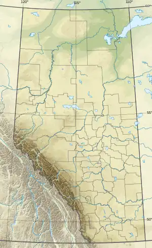
| Haiduk Peak | |
|---|---|
 Haiduk Peak  Haiduk Peak | |
| Highest point | |
| Elevation | 2,920 m (9,580 ft)[1] |
| Prominence | 230 m (750 ft)[2] |
| Parent peak | Scarab Peak[2] |
| Listing | Mountains of Alberta Mountains of British Columbia |
| Coordinates | 51°06′12″N 115°57′06″W / 51.10333°N 115.95167°W[2] |
| Geography | |
| Country | Canada |
| Provinces | Alberta and British Columbia |
| Parent range | Ball Range |
| Topo map | NTS 82O4 Banff |
| Climbing | |
| First ascent | 1934 |
| Easiest route | rock climb (?) |
Haiduk Peak is a 2,920-metre (9,580 ft) peak, probably after Haiduk, district, Hungary or Hideghut (Haiduk), village of Rumania. Haiduk Peak is located on the Continental Divide on the border of Banff and Kootenay National Parks at the head of Haiduk Creek. The mountain was named in 1917,[3] probably after the Haiduks of the Balkans.[1] The name was adopted on 31 December 1928.[4]
References
- 1 2 "Haiduk Peak". cdnrockiesdatabases.ca. Retrieved 2019-06-11.
- 1 2 3 "Haiduk Peak". Bivouac.com. Retrieved 2019-06-11.
- ↑ "Haiduk Peak". BC Geographical Names. Retrieved 2019-06-11.
- ↑ "Haiduk Peak". Geographical Names Data Base. Natural Resources Canada. Retrieved 2019-06-11.
External links
This article is issued from Wikipedia. The text is licensed under Creative Commons - Attribution - Sharealike. Additional terms may apply for the media files.