Florencio Varela | |
|---|---|
City | |
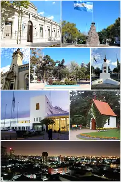
 Former town hall, actual museum. Flag Monument (Bicho Canasto). San Juan Bautista Church. San Juan Bautista square. General San Martín on the avenue of the same name. Arturo Jauretche Nacional University main building. Schönstatt Sanctuary. Nocturn view of down town. | |
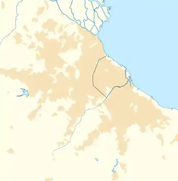
 Florencio Varela Location in Greater Buenos Aires | |
| Coordinates: 34°49′S 58°17′W / 34.817°S 58.283°W | |
| Country | |
| Province | |
| Partido | Florencio Varela |
| Founded | January 30, 1891 |
| Elevation | 125 m (410 ft) |
| Population | |
| • Total | 131,841 |
| CPA Base | B 1888 |
| Area code | +54 11 |
Florencio Varela is a city in Buenos Aires Province, Argentina. It is the administrative centre for Florencio Varela Partido. It forms part of the urban agglomeration of Greater Buenos Aires.
The settlement was officially founded on 30 January 1891 by Juan de la Cruz Contreras. It is named after Argentine writer and journalist Florencio Varela.
External links
 Media related to Florencio Varela city at Wikimedia Commons
- Municipal information: Municipal Affairs Federal Institute (IFAM), Municipal Affairs Secretariat, Ministry of Interior, Argentina. (in Spanish)
This article is issued from Wikipedia. The text is licensed under Creative Commons - Attribution - Sharealike. Additional terms may apply for the media files.