Castelar | |
|---|---|
City | |
 Castelar Location in Greater Buenos Aires | |
| Coordinates: 34°40′S 58°40′W / 34.667°S 58.667°W | |
| Country | |
| Province | [Image:Bandera de la Provincia de Buenos Aires.svg |
| Partido | Morón |
| Declared city | 1971 |
| Elevation | 28 m (92 ft) |
| Population | |
| • Total | 104,019 |
| CPA Base | B 1712 |
| Area code | +54 11 |

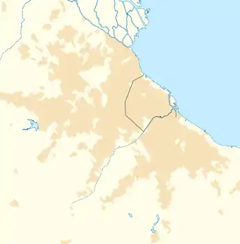
Castelar is a city in Morón Partido (county), Buenos Aires Province, Argentina, some 30 km west of the nation's capital, the autonomous city of Buenos Aires. It is part of the Greater Buenos Aires metropolitan area.
Castelar is the westernmost city of the Morón Partido, and borders on Ituzaingó Partido.
It is the second most populated city in Morón, and it's located in the western side of it.
Climate
| Climate data for Castelar (1991–2020, extremes 1961–present) | |||||||||||||
|---|---|---|---|---|---|---|---|---|---|---|---|---|---|
| Month | Jan | Feb | Mar | Apr | May | Jun | Jul | Aug | Sep | Oct | Nov | Dec | Year |
| Record high °C (°F) | 42.6 (108.7) |
39.2 (102.6) |
36.3 (97.3) |
32.5 (90.5) |
29.8 (85.6) |
27.2 (81.0) |
31.1 (88.0) |
29.7 (85.5) |
34.0 (93.2) |
35.4 (95.7) |
38.0 (100.4) |
38.9 (102.0) |
42.6 (108.7) |
| Mean daily maximum °C (°F) | 29.9 (85.8) |
28.6 (83.5) |
26.6 (79.9) |
22.7 (72.9) |
18.9 (66.0) |
15.9 (60.6) |
15.1 (59.2) |
17.6 (63.7) |
19.4 (66.9) |
22.3 (72.1) |
25.5 (77.9) |
28.5 (83.3) |
22.6 (72.7) |
| Daily mean °C (°F) | 23.9 (75.0) |
22.8 (73.0) |
20.8 (69.4) |
17.0 (62.6) |
13.6 (56.5) |
10.9 (51.6) |
9.9 (49.8) |
12.0 (53.6) |
14.0 (57.2) |
16.9 (62.4) |
19.9 (67.8) |
22.6 (72.7) |
17.0 (62.6) |
| Mean daily minimum °C (°F) | 18.2 (64.8) |
17.5 (63.5) |
15.6 (60.1) |
11.9 (53.4) |
8.9 (48.0) |
6.2 (43.2) |
5.4 (41.7) |
6.8 (44.2) |
8.7 (47.7) |
11.5 (52.7) |
13.9 (57.0) |
16.4 (61.5) |
11.7 (53.1) |
| Record low °C (°F) | 7.0 (44.6) |
5.9 (42.6) |
2.7 (36.9) |
1.4 (34.5) |
−1.9 (28.6) |
−6.3 (20.7) |
−5.0 (23.0) |
−2.5 (27.5) |
−2.1 (28.2) |
0.0 (32.0) |
2.9 (37.2) |
5.8 (42.4) |
−6.3 (20.7) |
| Average precipitation mm (inches) | 105.5 (4.15) |
112.3 (4.42) |
110.7 (4.36) |
104.7 (4.12) |
79.4 (3.13) |
49.7 (1.96) |
56.0 (2.20) |
58.2 (2.29) |
65.7 (2.59) |
114.1 (4.49) |
103.0 (4.06) |
98.0 (3.86) |
1,057.2 (41.62) |
| Average precipitation days (≥ 0.1 mm) | 8.3 | 7.5 | 8.1 | 8.1 | 7.0 | 6.2 | 6.1 | 5.9 | 6.7 | 8.9 | 7.9 | 8.0 | 88.6 |
| Average snowy days | 0.0 | 0.0 | 0.0 | 0.0 | 0.0 | 0.0 | 0.1 | 0.0 | 0.0 | 0.0 | 0.0 | 0.0 | 0.1 |
| Average relative humidity (%) | 67.4 | 72.4 | 75.6 | 80.0 | 82.3 | 81.5 | 79.7 | 74.9 | 72.6 | 73.3 | 69.8 | 66.6 | 74.7 |
| Mean monthly sunshine hours | 291.4 | 245.8 | 232.5 | 192.0 | 167.4 | 144.0 | 155.0 | 182.9 | 192.0 | 226.3 | 258.0 | 288.3 | 2,575.6 |
| Mean daily sunshine hours | 9.4 | 8.7 | 7.5 | 6.4 | 5.4 | 4.8 | 5.0 | 5.9 | 6.4 | 7.3 | 8.6 | 9.3 | 7.0 |
| Percent possible sunshine | 70 | 71 | 66 | 64 | 59 | 46 | 48 | 55 | 58 | 57 | 64 | 65 | 60 |
| Source 1: Servicio Meteorológico Nacional (extremes 1961–present at Morón Airport and Air Base)[1][2] | |||||||||||||
| Source 2: UNLP (percent sun 1971–1980)[3] | |||||||||||||
Economy
The Sero electric factory is located in Castelar.
History
The first owner of the land now known as Castelar was Mateo Sanchez, who received a squared portion of land laid upon Moron Creek ―the zone previously known as Cañada de Ruiz― according to the orders of the governor Juan Ramirez de Velasco. Surprisingly, the limits of that land were almost double the size of the current city. In 1610 the land suffered its first change of owner, since Mateo Sanchez had sold it to captain Francisco Romero from Santa Cruz. The lot continued to be in the hands of Romero's descendants until 1673, the year that Sebastian de Gilles acquired it, which led to a slow fragmenting of the land.
Notable residents
- Daniel Guerrero - television and film actor, radio announcer and television show host
- Brian Smith - racing driver
See also
References
- ↑ "Estadísticas Climatológicas Normales – período 1991–2020" (PDF) (in Spanish). Servicio Meteorológico Nacional. 2023. Archived from the original on 8 July 2023. Retrieved 31 July 2023.
- ↑ "Clima en la Argentina: Guia Climática por Morón Aero". Caracterización: Estadísticas de largo plazo (in Spanish). Servicio Meteorológico Nacional. Retrieved 31 July 2023.
- ↑ "Datos bioclimáticos de 173 localidades argentinas". Atlas Bioclimáticos (in Spanish). Universidad Nacional de La Plata. Retrieved July 4, 2016.
External links
- (in Spanish) Castelar railway station on Google Maps
- (in Spanish) Castelar Digital
- (in Spanish) Historia y actualidad de Moron, Argentina