Budoia
| |
|---|---|
| Comune di Budoia | |
Location of Budoia | |
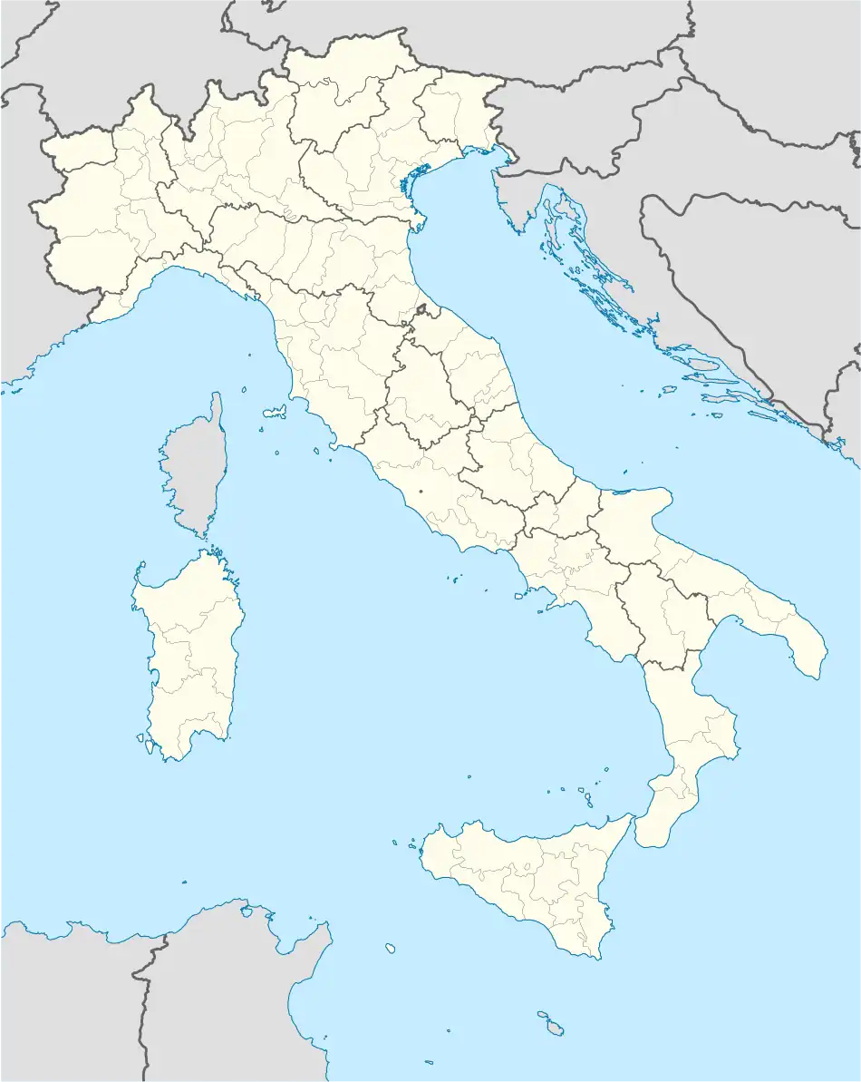 Budoia Location of Budoia in Italy 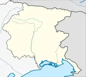 Budoia Budoia (Friuli-Venezia Giulia) | |
| Coordinates: 46°3′N 12°32′E / 46.050°N 12.533°E | |
| Country | Italy |
| Region | Friuli Venezia Giulia |
| Province | Pordenone (PN) |
| Frazioni | Dardago and Santa Lucia |
| Government | |
| • Mayor | Roberto De Marchi (From 2009) |
| Area | |
| • Total | 37.7 km2 (14.6 sq mi) |
| Elevation | 135 m (443 ft) |
| Population (Dec. 2004)[2] | |
| • Total | 2,311 |
| • Density | 61/km2 (160/sq mi) |
| Demonym | Budoiese |
| Time zone | UTC+1 (CET) |
| • Summer (DST) | UTC+2 (CEST) |
| Postal code | 33070 |
| Dialing code | 0434 |
| Patron saint | L'Assunta (Dardago), Sant'Andrea (Budoia), Santa Lucia (Santa Lucia) |
| Saint day | 15 Agosto, 30 Novembre, 13 Dicembre |
Budoia (Standard Friulian: Budoie; Western Friulian: Buduoia) is a comune (municipality) in the Regional decentralization entity of Pordenone at the foot of the Dolomites mountain range in the Italian region of Friuli Venezia Giulia, located about 110 kilometres (68 mi) northwest of Trieste and about 13 kilometres (8 mi) northwest of Pordenone. As of 31 December 2004, it had a population of 2,311 and an area of 37.7 square kilometres (14.6 sq mi).[3]
The municipality of Budoia comprises the frazioni (boroughs) of Dardago and Santa Lucia.
Budoia borders the following municipalities: Aviano, Fontanafredda, Polcenigo, Tambre.
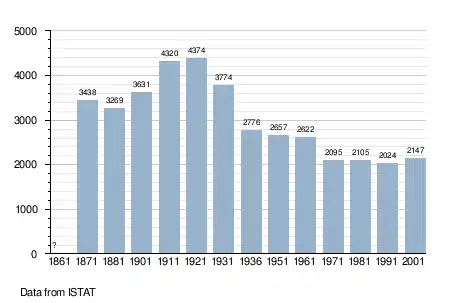
Demographic evolution
References
- ↑ "Superficie di Comuni Province e Regioni italiane al 9 ottobre 2011". Italian National Institute of Statistics. Retrieved 16 March 2019.
- ↑ "Popolazione Residente al 1° Gennaio 2018". Italian National Institute of Statistics. Retrieved 16 March 2019.
- ↑ All demographics and other statistics: Italian statistical institute Istat.
External links
This article is issued from Wikipedia. The text is licensed under Creative Commons - Attribution - Sharealike. Additional terms may apply for the media files.