Boulogne-sur-Helpe | |
|---|---|
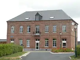 The town hall in Boulogne-sur-Helpe | |
.svg.png.webp) Coat of arms | |
Location of Boulogne-sur-Helpe | |
 Boulogne-sur-Helpe 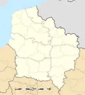 Boulogne-sur-Helpe | |
| Coordinates: 50°04′47″N 3°53′47″E / 50.0797°N 3.8964°E | |
| Country | France |
| Region | Hauts-de-France |
| Department | Nord |
| Arrondissement | Avesnes-sur-Helpe |
| Canton | Avesnes-sur-Helpe |
| Intercommunality | CC Cœur de l'Avesnois |
| Government | |
| • Mayor (2020–2026) | Nadine Majka[1] |
| Area 1 | 8.7 km2 (3.4 sq mi) |
| Population | 310 |
| • Density | 36/km2 (92/sq mi) |
| Time zone | UTC+01:00 (CET) |
| • Summer (DST) | UTC+02:00 (CEST) |
| INSEE/Postal code | 59093 /59440 |
| Elevation | 144–207 m (472–679 ft) (avg. 177 m or 581 ft) |
| 1 French Land Register data, which excludes lakes, ponds, glaciers > 1 km2 (0.386 sq mi or 247 acres) and river estuaries. | |
Boulogne-sur-Helpe (French pronunciation: [bulɔɲ syʁ ɛlp], literally Boulogne on Helpe) is a commune in the Nord department in northern France.[3]
Population
| Year | Pop. | ±% p.a. |
|---|---|---|
| 1968 | 387 | — |
| 1975 | 346 | −1.59% |
| 1982 | 315 | −1.33% |
| 1990 | 319 | +0.16% |
| 1999 | 317 | −0.07% |
| 2009 | 330 | +0.40% |
| 2014 | 328 | −0.12% |
| 2020 | 325 | −0.15% |
| Source: INSEE[4] | ||
Heraldry
Arms of Boulogne-sur-Helpe |
The arms of Boulogne-sur-Helpe are blazoned : Argent, 3 fesses gules. (Boulogne-sur-Helpe and Petit-Fayt use the same arms.)
|
See also
References
- ↑ "Répertoire national des élus: les maires". data.gouv.fr, Plateforme ouverte des données publiques françaises (in French). 9 August 2021.
- ↑ "Populations légales 2021". The National Institute of Statistics and Economic Studies. 28 December 2023.
- ↑ INSEE commune file
- ↑ Population en historique depuis 1968, INSEE
Wikimedia Commons has media related to Boulogne-sur-Helpe.
This article is issued from Wikipedia. The text is licensed under Creative Commons - Attribution - Sharealike. Additional terms may apply for the media files.