Bazuel | |
|---|---|
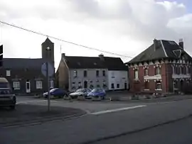 A view within Bazuel | |
_Nord-France.svg.png.webp) Coat of arms | |
Location of Bazuel | |
 Bazuel 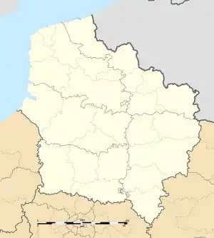 Bazuel | |
| Coordinates: 50°05′30″N 3°35′21″E / 50.0917°N 3.5892°E | |
| Country | France |
| Region | Hauts-de-France |
| Department | Nord |
| Arrondissement | Cambrai |
| Canton | Le Cateau-Cambrésis |
| Intercommunality | CA Caudrésis–Catésis |
| Government | |
| • Mayor (2020–2026) | Jean-Félix Macarez[1] |
| Area 1 | 11.81 km2 (4.56 sq mi) |
| Population | 537 |
| • Density | 45/km2 (120/sq mi) |
| Time zone | UTC+01:00 (CET) |
| • Summer (DST) | UTC+02:00 (CEST) |
| INSEE/Postal code | 59055 /59360 |
| Elevation | 112–158 m (367–518 ft) |
| 1 French Land Register data, which excludes lakes, ponds, glaciers > 1 km2 (0.386 sq mi or 247 acres) and river estuaries. | |
Bazuel (French pronunciation: [bazɥɛl]) is a commune in the Nord department in northern France.[3]
It is 4 km (2.5 mi) southeast of Le Cateau-Cambrésis, and 25 km (16 mi) southeast of Cambrai.
Population
| Year | Pop. | ±% p.a. |
|---|---|---|
| 1968 | 801 | — |
| 1975 | 795 | −0.11% |
| 1982 | 726 | −1.29% |
| 1990 | 674 | −0.92% |
| 1999 | 571 | −1.83% |
| 2009 | 578 | +0.12% |
| 2014 | 547 | −1.10% |
| 2020 | 526 | −0.65% |
| Source: INSEE[4] | ||
Heraldry
Arms of Basuel |
The arms of Bazuel are blazoned : Gules, a rose slipped and leaved argent. (Bazuel, Maretz and Saint-Benin use the same arms.)
|
See also
References
- ↑ "Répertoire national des élus: les maires" (in French). data.gouv.fr, Plateforme ouverte des données publiques françaises. 13 September 2022.
- ↑ "Populations légales 2021". The National Institute of Statistics and Economic Studies. 28 December 2023.
- ↑ INSEE commune file
- ↑ Population en historique depuis 1968, INSEE
Wikimedia Commons has media related to Bazuel.
This article is issued from Wikipedia. The text is licensed under Creative Commons - Attribution - Sharealike. Additional terms may apply for the media files.