Bietlenheim
Bietle | |
|---|---|
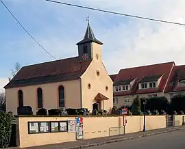 The Protestant church in Bietlenheim | |
 Coat of arms | |
Location of Bietlenheim | |
 Bietlenheim  Bietlenheim | |
| Coordinates: 48°43′11″N 7°46′56″E / 48.7197°N 7.7822°E | |
| Country | France |
| Region | Grand Est |
| Department | Bas-Rhin |
| Arrondissement | Haguenau-Wissembourg |
| Canton | Brumath |
| Government | |
| • Mayor (2020–2026) | Patrick Kieffer[1] |
| Area 1 | 2.13 km2 (0.82 sq mi) |
| Population | 308 |
| • Density | 140/km2 (370/sq mi) |
| Time zone | UTC+01:00 (CET) |
| • Summer (DST) | UTC+02:00 (CEST) |
| INSEE/Postal code | 67038 /67720 |
| Elevation | 133–168 m (436–551 ft) |
| 1 French Land Register data, which excludes lakes, ponds, glaciers > 1 km2 (0.386 sq mi or 247 acres) and river estuaries. | |
Bietlenheim (French pronunciation: [bitlənaim] ⓘ) is a commune in the Bas-Rhin department in Grand Est in northeastern France.[3]
Population
| Year | Pop. | ±% p.a. |
|---|---|---|
| 1968 | 155 | — |
| 1975 | 182 | +2.32% |
| 1982 | 208 | +1.93% |
| 1990 | 260 | +2.83% |
| 1999 | 279 | +0.79% |
| 2009 | 282 | +0.11% |
| 2014 | 270 | −0.87% |
| 2020 | 301 | +1.83% |
| Source: INSEE[4] | ||
See also
References
- ↑ "Répertoire national des élus: les maires". data.gouv.fr, Plateforme ouverte des données publiques françaises (in French). 2 December 2020.
- ↑ "Populations légales 2021". The National Institute of Statistics and Economic Studies. 28 December 2023.
- ↑ INSEE commune file
- ↑ Population en historique depuis 1968, INSEE
Wikimedia Commons has media related to Bietlenheim.
This article is issued from Wikipedia. The text is licensed under Creative Commons - Attribution - Sharealike. Additional terms may apply for the media files.