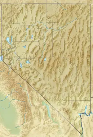
 Winnemucca Lovelock | |
| UTC time | 1914-04-24 08:35:00 |
|---|---|
| USGS-ANSS | ComCat |
| ComCat | |
| Local date | February 18, 1914 |
| Magnitude | 6.4 Mw |
| Epicenter | 39°30′00″N 119°48′00″W / 39.500°N 119.800°W |
| Fault | Walker Lane Seismic Zone |
| Areas affected | Nevada, United States |
The 1914 Reno earthquakes were a series of earthquakes in February and April 1914 in Reno, Nevada and the surrounding area. The 6.0 magnitude foreshock occurred on February 18, 1914, at 10:17am local time.[1][2] The 6.4 magnitude main quake occurred at 12:34am local time.[2][3] This event stands as a pivotal moment in the quivering history of the United State, leaving an indelible mark on the city of Reno, Nevada, contributing significantly to the understanding of seismic activity in the region.
Geological Factors
Nevada, often known by its vast landscapes and natural beauty, masks a seismic history as complex as its terrain. “Tens of thousands of microearthquakes occur in Nevada every year”[4] with intermittent larger mountains – forming earthquakes leaving lasting impressions on both the land and its inhabitants.
The 1914 Reno earthquake & its associated series of seismic events were likely caused by the tectonic activity along fault lines in the region.[2] The western United States is known for its complex tectonic settings, where the Pacific Plate & the North American Plate interact. In this area, earthquakes are commonly associated with the movement of these plates along faults.[2]
Fault lines in the intermountain region grew & multiplied, leading to secondary flows that metamorphosed into various types of porphyrins such as andesites, dacites, and rhyolites.[2] The earth’s crust, influenced by forces like electrical energy & the expansions of superheated matter, remained in a dynamic state, reopening old crevices & causing transverse and parallel fissures.[2]
More specifically, the 1914 Reno earthquake was along a fault line near the Nevada-California border.[4] The shifting of the Earth's crust along faults is a consequence of the broader plate tectonics and the gradual buildup of stress along these fault lines. Once this accumulated stress exceeds the strength of the rocks, it triggers the release of energy in the form of seismic waves, ultimately resulting in earthquakes.
Events Leading Up to the Earthquakes
Nevada's seismic activity became evident in the mid-19th century, particularly marked by a series of earthquakes from the 1840s to the 1860s. Within the timeframe of 1855-1869, the region around Reno witnessed a cluster of significant events.[4] In 1855, the first notable earthquake with a magnitude of 6 struck Sierraville, California.[4] Two years later, in 1857, a magnitude 6.3 earthquake occurred to the north of Lake Tahoe.[4] Additionally, a magnitude 6.5 tremor in 1860 shook western Nevada and Eastern California.[4]
Main Earthquakes
February 18th, 1914
The first earthquake occurred on February 18th, with a magnitude of 6, striking at 10:17am. The event lasted for 10-11 seconds, characterized by intense shaking that gradually subsided within half a minute.[2]
This earthquake caused various damages in Reno, such as broken windows, cracked walls & the collapse of a section of a brick firewall in the downtown area.[2] At the University of Nevada, Reno, bricks were thrown from chimneys and the seismoscope was active for 20 seconds.[2][4] In Virginia City, damages included broken windows at the Fourth Ward School, bricks were thrown, and plaster was cracked in buildings.[2] Aftershocks continued into March before quieting down.[2]
April 24th, 1914
In 1914, the seismic activity in Reno, Nevada, peaked with "the largest event in the 1914 Reno earthquake sequence, and it was the largest earthquake in the United States that year."[2][5] On April 23, 1914, at 4:02 a.m., a subtle foreshock initiated the seismic buildup, followed by a more pronounced foreshock at 8:03 a.m. that stirred excitement in Reno.[2][4] The culmination unfolded at 12:34 a.m. on April 24th when the main shock, measuring a magnitude of 6.4, transpired.[4] Its impact resonated throughout western Nevada and extended into the Sacramento Valley in California.[4] Professor J.C. Jones of the University of Nevada noted substantial movement on the seismoscope in the Mackay School of Mines Building, with the attached wall oscillating ¾ of an inch in an east-west direction and nearly as much in a north-south direction.[4] The seismic events of 1914 left an enduring mark on the region, causing structural damage and leaving a lasting record of seismic effects.
See also
References
- ↑ "M 6.0 - Nevada". United States Geological Survey. Archived from the original on January 29, 2021. Retrieved January 29, 2021.
- 1 2 3 4 5 6 7 8 9 10 11 12 13 dePolo, Craig M.; Garside, Terri M. (March 2006). The November 21, 1910 Tonopah Junction Earthquake, and the February 18, 1914 and April 24, 1914 Reno Earthquakes in Nevada (PDF). Nevada Bureau of Mines and Geology. Archived (PDF) from the original on January 29, 2021. Retrieved January 29, 2021.
- ↑ "M 6.4 - Nevada". United States Geological Survey. Archived from the original on January 29, 2021. Retrieved January 29, 2021.
- 1 2 3 4 5 6 7 8 9 10 11 "Nevada's Earthquake History" (PDF). Shakeout. Retrieved 2023-01-12.
- ↑ "Anniversary of April 24, 1914 Earthquake in Reno—TODAY". Blog of the Nevada Bureau of Mines and Geology. 2019-04-24. Retrieved 2024-01-12.