Ševětín | |
|---|---|
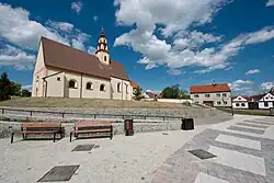 Town square with the Church of Saint Nicholas | |
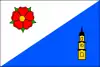 Flag 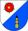 Coat of arms | |
 Ševětín Location in the Czech Republic | |
| Coordinates: 49°6′0″N 14°34′20″E / 49.10000°N 14.57222°E | |
| Country | |
| Region | South Bohemian |
| District | České Budějovice |
| First mentioned | 1352 |
| Area | |
| • Total | 8.11 km2 (3.13 sq mi) |
| Elevation | 484 m (1,588 ft) |
| Population (2023-01-01)[1] | |
| • Total | 1,377 |
| • Density | 170/km2 (440/sq mi) |
| Time zone | UTC+1 (CET) |
| • Summer (DST) | UTC+2 (CEST) |
| Postal code | 373 63 |
| Website | www |
Ševětín is a market town in České Budějovice District in the South Bohemian Region of the Czech Republic. It has about 1,400 inhabitants.
Ševětín lies approximately 16 kilometres (10 mi) north-east of České Budějovice and 111 km (69 mi) south of Prague.
Economy
Ševětín Solar Park is located in Ševětín.
References
Wikimedia Commons has media related to Ševětín.
This article is issued from Wikipedia. The text is licensed under Creative Commons - Attribution - Sharealike. Additional terms may apply for the media files.