Woods Hole, Massachusetts
Woods Hole is a census-designated place and village within the town of Falmouth in Barnstable County, Massachusetts, at the extreme southwest corner of Cape Cod, near Martha's Vineyard and the Elizabeth Islands.
Woods Hole, Massachusetts | |
|---|---|
 | |
 Location in Barnstable County and the state of Massachusetts. | |
| Coordinates: 41°31′36″N 70°39′47″W | |
| Country | United States |
| State | Massachusetts |
| County | Barnstable |
| Town | Falmouth |
| Area | |
| • Total | 3.93 sq mi (10.19 km2) |
| • Land | 2.13 sq mi (5.53 km2) |
| • Water | 1.80 sq mi (4.66 km2) |
| Elevation | 20 ft (6 m) |
| Population | |
| • Total | 834 |
| • Density | 390.63/sq mi (150.79/km2) |
| Time zone | UTC-5 (Eastern (EST)) |
| • Summer (DST) | UTC-4 (EDT) |
| ZIP code | 02543 |
| Area code | 508 |
| FIPS code | 25-81245 |
| GNIS feature ID | 0617060 |
References
- "2020 U.S. Gazetteer Files". United States Census Bureau. Retrieved May 21, 2022.
- "Profile of General Population and Housing Characteristics: 2020 Demographic Profile Data (DP-1): Woods Hole CDP, Massachusetts". United States Census Bureau. Retrieved March 5, 2024.
Other websites
![]() Media related to Woods Hole, Massachusetts at Wikimedia Commons
Media related to Woods Hole, Massachusetts at Wikimedia Commons
Municipalities and communities of Barnstable County, Massachusetts, United States | ||
|---|---|---|
| City | 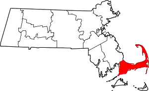 | |
| Towns | ||
| CDPs |
| |
| Other villages |
| |
This article is issued from Wikipedia. The text is licensed under Creative Commons - Attribution - Sharealike. Additional terms may apply for the media files.