Westerstede
Westerstede (Low German: Westerstäe) is the capital of the Ammerland district, in Lower Saxony, Germany. It is about 25 km northwest of Oldenburg.
Westerstede | |
|---|---|
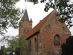 St Peters Church (St Petri Kirche) | |
 Flag  Coat of arms | |
Location of Westerstede within Ammerland district 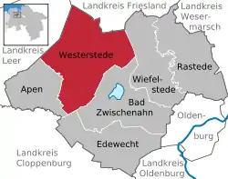 | |
 Westerstede 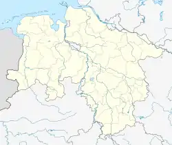 Westerstede | |
| Coordinates: 53°15′N 7°55′E | |
| Country | Germany |
| State | Lower Saxony |
| District | Ammerland |
| Subdivisions | 24 districts |
| Government | |
| • Mayor (2019–24) | Michael Rösner[1] |
| Area | |
| • Total | 179 km2 (69 sq mi) |
| Elevation | 6 m (20 ft) |
| Population (2022-12-31)[2] | |
| • Total | 23,854 |
| • Density | 130/km2 (350/sq mi) |
| Time zone | UTC+01:00 (CET) |
| • Summer (DST) | UTC+02:00 (CEST) |
| Postal codes | 26655 |
| Dialling codes | 04488, 04409 |
| Vehicle registration | WST |
| Website | www.westerstede.de |
The villages of Burgforde, Eggeloge, Felde, Fikensolt, Garnholt, Gießelhorst, Halsbek, Halstrup, Hollriede, Hollwege, Hollwegerfeld, Hüllstede, Ihausen, Ihorst, Karlshof, Linswege, Linswegerfeld, Mansie, Lindern, Moorburg, Neuengland, Ocholt, Ocholterfeld, Ollenharde, Petersfeld, Tarbarg, Torsholt, Westerloy, Westerloyerfeld and Westerstederfeld are part of Westerstede.
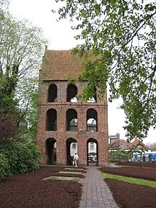
Belltower for St Peters Church - The belltower for Westerstede's St. Peters Church is housed in its own building next to the church.
The railway station of Westerstede is in the village of Ocholt, 6 km south of the town.
Other websites
This article is issued from Wikipedia. The text is licensed under Creative Commons - Attribution - Sharealike. Additional terms may apply for the media files.