Vaterstetten
Vaterstetten is a municipality in the Upper Bavarian district of Ebersberg. It is east of Munich and is the district's biggest community. Vaterstetten is on the outskirts of Munich, about twenty minutes by S-Bahn from Marienplatz.
Vaterstetten | |
|---|---|
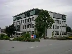 Town hall | |
 Coat of arms | |
Location of Vaterstetten within Ebersberg district  | |
 Vaterstetten  Vaterstetten | |
| Coordinates: 48°06′18″N 11°46′14″E | |
| Country | Germany |
| State | Bavaria |
| Admin. region | Oberbayern |
| District | Ebersberg |
| Subdivisions | 7 officially named centres |
| Government | |
| • Mayor (2020–26) | Leonhard Spitzauer[1] (CSU) |
| Area | |
| • Total | 34.18 km2 (13.20 sq mi) |
| Elevation | 528 m (1,732 ft) |
| Population (2022-12-31)[2] | |
| • Total | 25,530 |
| • Density | 750/km2 (1,900/sq mi) |
| Time zone | UTC+01:00 (CET) |
| • Summer (DST) | UTC+02:00 (CEST) |
| Postal codes | 85591 |
| Dialling codes | 08106 |
| Vehicle registration | EBE |
| Website | www.vaterstetten.de |
Geography
Location
Vaterstetten borders in the north on the community of Poing, in the northeast on the community of Anzing, in the east on the unincorporated area of the Ebersberg Forest (Ebersberger Forst), in the southeast on the community of Zorneding (all in Ebersberg district), in the southwest on the community of Grasbrunn, and in the west on the communities of Haar and Feldkirchen (all three in Munich district).
Constituent communities
The community conttains of the constituent centres of Baldham, Hergolding, Neufarn, Parsdorf, Purfing, Vaterstetten and Weißenfeld.
References
- Liste der ersten Bürgermeister/Oberbürgermeister in kreisangehörigen Gemeinden, Bayerisches Landesamt für Statistik, accessed 19 July 2021.
- Genesis Online-Datenbank des Bayerischen Landesamtes für Statistik Tabelle 12411-003r Fortschreibung des Bevölkerungsstandes: Gemeinden, Stichtag (Einwohnerzahlen auf Grundlage des Zensus 2011) .
Other websites
- Official website
 (in German)
 - Partnership with Alem Katema