Vanua Levu
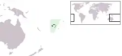
Vanua Levu (pronounced [βanua leβu]), formerly known as Sandalwood Island, is the second largest island of Fiji. It is 64 kilometres to the north of the larger island Viti Levu, the island has an area of 5,587.1 km² and a population of 130,000.
 Map of Vanua Levu | |
 | |
| Geography | |
|---|---|
| Location | Pacific Ocean |
| Coordinates | 16°35′S 179°11′E |
| Archipelago | Vanua Levu Group |
| Area | 5,587.1 km2 (2,157.2 sq mi) |
| Length | 180 km (112 mi) |
| Width | 50 km (31 mi) |
| Highest elevation | 1,111 m (3645 ft) |
| Highest point | Mount Batini |
| Administration | |
Fiji | |
| Division | Northern Division |
| Largest settlement | Labasa (pop. 25,000) |
| Demographics | |
| Population | 130,000 |
| Pop. density | 23.27/km2 (60.27/sq mi) |
| Ethnic groups | Mainly Native Fijians and Fiji Indians |
This article is issued from Wikipedia. The text is licensed under Creative Commons - Attribution - Sharealike. Additional terms may apply for the media files.