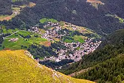
Valtournenche
Valtournenche is a comune in the Aosta Valley region in Italy. It is named after the valley of the same name.
Valtournenche | |
|---|---|
| Comune di Valtournenche Commune de Valtournenche | |
 | |
.svg.png.webp) Coat of arms | |
Location of Valtournenche | |
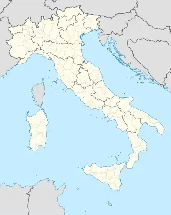 Valtournenche Location of Valtournenche in Italy 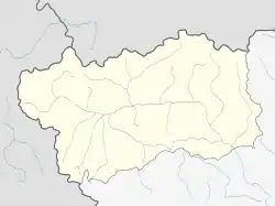 Valtournenche Valtournenche (Aosta Valley) | |
| Coordinates: 45°53′N 07°37′E | |
| Country | Italy |
| Region | Aosta Valley |
| Frazioni | Barmasse, Bioley, Brengaz, Breuil-Cervinia, Busserailles, Chaloz, Châtelard, Champ l'éve, Cheneil, Cheperon, Tsignanaz (Cignana), Clou, Cré, Cré-du-Pont, Crépin, Crétaz, Duerche, Euillaz, Fontaine, La Muranche, La Vénaz, Layet, Laviel, Le Lou (Loz), Losanche, Maën, Maisonnasse, Montaz, Moulin, Mont-Mené, Mont-Perron, Pâquier (chef-lieu), Pecou, Les Perrères, Pessey, Promindoz, Saix, Servaz, Singlin, Tourtourouse, Ussin, Valmartin |
| Government | |
| • Mayor | Jean-Antoine Maquignaz |
| Area | |
| • Total | 116.15 km2 (44.85 sq mi) |
| Elevation | 1,524 m (5,000 ft) |
| Population (31 December 2020)[2] | |
| • Total | 2,256 |
| • Density | 19/km2 (50/sq mi) |
| Demonym | Valtournains |
| Time zone | UTC+1 (CET) |
| • Summer (DST) | UTC+2 (CEST) |
| Postal code | 11028 |
| Dialing code | 0166 |
| ISTAT code | 7071 |
| Patron saint | St. Anthony the Abbot |
| Saint day | 17 January |
| Website | Official website |
References
- "Superficie di Comuni Province e Regioni italiane al 9 ottobre 2011". Italian National Institute of Statistics. Retrieved 16 March 2019.
- "Popolazione Residente al 1° Gennaio 2018". Italian National Institute of Statistics. Retrieved 16 March 2019.

This article is issued from Wikipedia. The text is licensed under Creative Commons - Attribution - Sharealike. Additional terms may apply for the media files.