Thüngen
Thüngen (German: [ˈtʏŋən] (![]() listen)) is a market community in the Main-Spessart district in the Regierungsbezirk of Lower Franconia (Unterfranken) in Bavaria, Germany and a member of the Verwaltungsgemeinschaft (Administrative Community) of Zellingen.
listen)) is a market community in the Main-Spessart district in the Regierungsbezirk of Lower Franconia (Unterfranken) in Bavaria, Germany and a member of the Verwaltungsgemeinschaft (Administrative Community) of Zellingen.
Thüngen | |
|---|---|
 Coat of arms | |
Location of Thüngen within Main-Spessart district 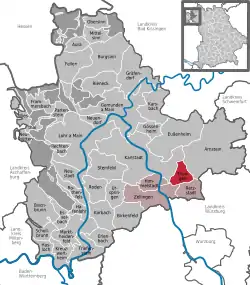 | |
 Thüngen  Thüngen | |
| Coordinates: 49°56′32″N 9°51′34″E | |
| Country | Germany |
| State | Bavaria |
| Admin. region | Unterfranken |
| District | Main-Spessart |
| Municipal assoc. | Zellingen |
| Government | |
| • Mayor (2020–26) | Lorenz Strifsky[1] (SPD) |
| Area | |
| • Total | 13.61 km2 (5.25 sq mi) |
| Elevation | 199 m (653 ft) |
| Population (2022-12-31)[2] | |
| • Total | 1,454 |
| • Density | 110/km2 (280/sq mi) |
| Time zone | UTC+01:00 (CET) |
| • Summer (DST) | UTC+02:00 (CEST) |
| Postal codes | 97289 |
| Dialling codes | 09360 |
| Vehicle registration | MSP |
| Website | www.markt-thuengen.de |
Geography
Location
Thüngen is in the Würzburg Region, 25 km north of Würzburg and 30 km west of Schweinfurt, in the north of the Main Triangle (Maindreieck) on the river Wern.
The community has only the Gemarkung (traditional rural cadastral area) of Thüngen.
References
- Liste der ersten Bürgermeister/Oberbürgermeister in kreisangehörigen Gemeinden, Bayerisches Landesamt für Statistik, 15 July 2021.
- Genesis Online-Datenbank des Bayerischen Landesamtes für Statistik Tabelle 12411-003r Fortschreibung des Bevölkerungsstandes: Gemeinden, Stichtag (Einwohnerzahlen auf Grundlage des Zensus 2011) .
Further reading
- Fritz Kugler: Thüngener Heimatbuch, Markt Thüngen 1988, keine ISBN
- Hannskarl Frhr. von Thüngen: Das Haus Thüngen 788 - 1988. Geschichte eines fränkischen Adelsgeschlechts. Echter Verlag, Würzburg 1988, ISBN 3-429-01162-0.
Wikimedia Commons has media related to Thüngen.
Wikisource has original writing related to this article:
This article is issued from Wikipedia. The text is licensed under Creative Commons - Attribution - Sharealike. Additional terms may apply for the media files.