Têt (river)
The Têt (Catalan: Tet) is the largest river in Roussillon, southeastern France. The valley formed by the river, the Valley of the Têt (French: Vallée de la Têt), was named as Region of Art and History (French: Pays d'Art et d'Histoire) by the French Ministry of Culture and Communication.[1]
| Têt La Têt (French) | |
|---|---|
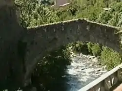 Têt near Villefranche-de-Conflent | |
.png.webp) | |
| Location | |
| Country | France |
| Physical characteristics | |
| Source | |
| - location | Pyrenees |
| - elevation | ±2,400 m (7,900 ft) |
| Mouth | |
| - location | Mediterranean Sea |
| - coordinates | 42°42′48″N 3°2′23″E |
| Length | 115 km (71 mi) |
| Basin size | 1,550 km2 (600 sq mi) |
| Discharge | |
| - average | 7.5 m3/s (260 cu ft/s) |
Geography
The Têt river is 115.8 kilometres (72.0 miles).[2] Its source is on the northeastern side of Pic Carlit at an elevation of 2,405 metres (7,890 feet), in the municipality of Angoustrine-Villeneuve-des-Escaldes.
It crosses the Pyrénées-Orientales département (Northern Catalonia) from West to East and ends in the Mediterranean Sea, near Perpignan (Catalan: Perpinyà).
Tributaries
The Têt has 43 tributaries;[2] some of them are:
- Right tributaries:
- Riberola (or Torrent de la Valleta), 10.3 kilometres (6.4 miles)
- Carança, 15.3 kilometres (9.5 miles)
- Mantet (or Rivière du Ressac, Ruisseau d'El Callau), 18.5 kilometres (11.5 miles)
- Rotja, 23.3 kilometres (14.5 miles)
- Cady, 19.2 km, flowing from the Le Canigou mountain.
- Lentillà, 24 kilometres (15 miles)
- Lliscou, 11.8 kilometres (7.3 miles)
- Boulès (or Bolès), 34.5 kilometres (21.4 miles)
- Basse, 11.6 kilometres (7.2 miles)
- Left tributaries
- Castellane, 27 kilometres (17 miles)
- Caillan, 20.9 kilometres (13.0 miles)
Towns along the river
Some towns and cities found along the river, with the Catalan name in parentheses, are:
- Mont-Louis (Mont-Lluis)
- Olette (Oleta)
- Villefranche-de-Conflent (Vilafranca de Conflent)
- Prades (Prada de Conflent)
- Perpignan (Perpinyà)
Gallery
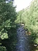 The Têt river near Villefranche-de-Conflent
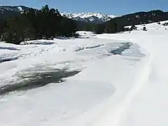 Frozen Têt near Bolquère
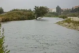 The Têt river in Perpignan
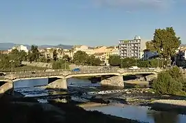 The Têt river in Perpignan
References
- "Villes et Pays d'art et d'histoire" (in French). Direction Génerale des Patrimonies. Archived from the original on 19 August 2020. Retrieved 11 July 2013.
- "Fiche cours d'eau - La Têt (Y04-0400)" (in French). SANDRE - Portail national d'accès aux référentiels sur l'eau. Archived from the original on 18 May 2015. Retrieved 11 July 2013.
Other websites
- Station: 70474030, Option: Synthèse Archived 2015-02-19 at the Wayback Machine (in French)
- La Tet Archived 2008-09-24 at the Wayback Machine (in French)