Stansstad
Stansstad is a municipality in the canton of Nidwalden in Switzerland.
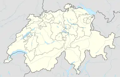
Stansstad | |
|---|---|
 Coat of arms | |
Location of Stansstad | |
 Stansstad 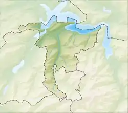 Stansstad | |
| Coordinates: 46°58′N 8°20′E | |
| Country | Switzerland |
| Canton | Nidwalden |
| District | n.a. |
| Area | |
| • Total | 17.11 km2 (6.61 sq mi) |
| Elevation | 436 m (1,430 ft) |
| Population (31 December 2018)[2] | |
| • Total | 4,576 |
| • Density | 270/km2 (690/sq mi) |
| Time zone | UTC+01:00 (Central European Time) |
| • Summer (DST) | UTC+02:00 (Central European Summer Time) |
| Postal code(s) | 6362 |
| SFOS number | 1510 |
| Surrounded by | Alpnach (OW), Ennetbürgen, Ennetmoos, Hergiswil, Horw (LU), Meggen (LU), Stans, Weggis (LU) |
| Website | www SFSO statistics |
The main sights of Stansstad are: a museum of the buildings, a tower (Schnitzturm), and the chaper Marie Linden in Kehrsiten.
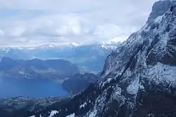
View from Pilatus to Bürgenstock and Lake Lucerne. Stansstad is in the middle of the picture at the shore of the lake.
References
- "Arealstatistik Standard - Gemeinden nach 4 Hauptbereichen". Federal Statistical Office. Retrieved 13 January 2019.
- "Ständige Wohnbevölkerung nach Staatsangehörigkeitskategorie Geschlecht und Gemeinde; Provisorische Jahresergebnisse; 2018". Federal Statistical Office. 9 April 2019. Retrieved 11 April 2019.
Other websites
![]() Media related to Stansstad at Wikimedia Commons
Media related to Stansstad at Wikimedia Commons
| ||
This article is issued from Wikipedia. The text is licensed under Creative Commons - Attribution - Sharealike. Additional terms may apply for the media files.