Souvigné-sur-Sarthe
Souvigné-sur-Sarthe is a commune. It is in the region Pays de la Loire in the Sarthe department in the west of France.
Souvigné-sur-Sarthe | |
|---|---|
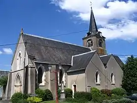 The church of Saint-Maurille | |
Location of Souvigné-sur-Sarthe | |
 Souvigné-sur-Sarthe  Souvigné-sur-Sarthe | |
| Coordinates: 47°49′36″N 0°23′16″W | |
| Country | France |
| Region | Pays de la Loire |
| Department | Sarthe |
| Arrondissement | La Flèche |
| Canton | Sablé-sur-Sarthe |
| Intercommunality | Communauté de communes de Sablé-sur-Sarthe |
| Government | |
| • Mayor (2008–2014) | Marie-France Plat |
| Area 1 | 17.06 km2 (6.59 sq mi) |
| Population (2006 [1]) | 619 |
| • Density | 36/km2 (94/sq mi) |
| Demonym(s) | Solviniacois, Solviniacoises Souvignéen, Souvignéenne |
| Time zone | UTC+01:00 (CET) |
| • Summer (DST) | UTC+02:00 (CEST) |
| INSEE/Postal code | 72343 /72300 |
| Elevation | 20–50 m (66–164 ft) |
| 1 French Land Register data, which excludes lakes, ponds, glaciers > 1 km2 (0.386 sq mi or 247 acres) and river estuaries. | |
Related pages
References
- http://www.insee.fr/fr/ppp/bases-de-donnees/recensement/populations-legales/departement.asp?dep=72#dep_B Populations légales 2006 publiées par l’INSEE le 1er janvier 2009
Other websites
![]() Media related to Souvigné-sur-Sarthe at Wikimedia Commons
Media related to Souvigné-sur-Sarthe at Wikimedia Commons
This article is issued from Wikipedia. The text is licensed under Creative Commons - Attribution - Sharealike. Additional terms may apply for the media files.