Schweinfurt (district)
Schweinfurt is a Landkreis (district) in the northwestern part of Bavaria, Germany.
Schweinfurt | |
|---|---|
 Flag  Coat of arms | |
| Country | Germany |
| State | Bavaria |
| Adm. region | Lower Franconia |
| Capital | Schweinfurt |
| Area | |
| • Total | 842 km2 (325 sq mi) |
| Population (31 December 2022)[1] | |
| • Total | 117,044 |
| • Density | 140/km2 (360/sq mi) |
| Time zone | UTC+01:00 (CET) |
| • Summer (DST) | UTC+02:00 (CEST) |
| Vehicle registration | SW |
| Website | landkreis-schweinfurt.de |
The primary rivers in the district are the Main and the Wern. The district is located between several hill chains - Haßberge to the east, the Rhön in the northwest, the Spessart to the west and the Steigerwald in the southeast.
Towns and municipalities
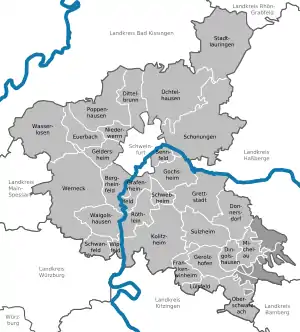
Towns and municipalities in Landkreis Schweinfurt
| Towns | Verwaltungsgemeinschaften | free municipalities |
|---|---|---|
|
Markt ¹ administrated within a |
|
|
References
- Genesis Online-Datenbank des Bayerischen Landesamtes für Statistik Tabelle 12411-003r Fortschreibung des Bevölkerungsstandes: Gemeinden, Stichtag (Einwohnerzahlen auf Grundlage des Zensus 2011) .
Other websites
Wikimedia Commons has media related to Landkreis Schweinfurt.
- Official website (German)
- Schweinfurt-Online www.SW-ON.de Information about the city Schweinfurt and the district of Schweinfurt
This article is issued from Wikipedia. The text is licensed under Creative Commons - Attribution - Sharealike. Additional terms may apply for the media files.