Placerville, California
Placerville is the county seat of El Dorado County, California. The population was 10,747 at the 2020 census.[5]
Placerville, California | |
|---|---|
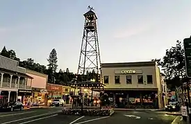 Bell Tower on Main Street | |
 Seal | |
| Nickname: Hangtown[1] | |
 Location of Placerville in California | |
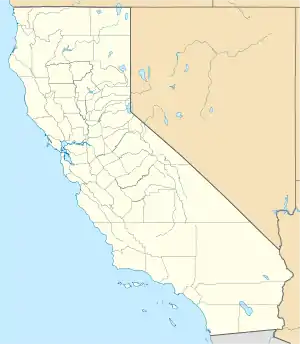 Placerville Location of Placerville in California  Placerville Location of Placerville in the United States | |
| Coordinates: 38°43′47″N 120°47′55″W[2] | |
| Country | |
| State | |
| County | |
| Incorporated | May 13, 1854[3] |
| Area | |
| • Total | 5.84 sq mi (15.13 km2) |
| • Land | 5.84 sq mi (15.13 km2) |
| • Water | 0.00 sq mi (0.00 km2) 0.01% |
| Elevation | 1,867 ft (569 m) |
| Population | |
| • Total | 10,747 |
| • Density | 1,913.53/sq mi (738.79/km2) |
| Time zone | UTC-8 (PST) |
| • Summer (DST) | UTC-7 (PDT) |
| ZIP code | 95667[6] |
| Area code | 530 |
| FIPS code | 06-57540 |
| GNIS feature IDs | 277577, 2411433 |
| Website | www |
California Historical Landmark | |
| Reference no. | 701[7] |
References
- "Placerville". Geographic Names Information System. United States Geological Survey.
- "US Gazetteer files: 2010, 2000, and 1990". United States Census Bureau. 2011-02-12. Retrieved 2011-04-23.
- "California Cities by Incorporation Date". California Association of Local Agency Formation Commissions. Archived from the original (Word) on November 3, 2014. Retrieved April 5, 2013.
- "2019 U.S. Gazetteer Files". United States Census Bureau. Retrieved July 1, 2020.
- "QuickFacts: Placerville city, California". United States Census Bureau. Retrieved August 24, 2023.
- "ZIP Code(tm) Lookup". United States Postal Service. Retrieved November 23, 2014.
- "Placerville". Office of Historic Preservation, California State Parks. Retrieved 2012-10-07.
Municipalities and communities of El Dorado County, California, United States | ||
|---|---|---|
| Cities |  El Dorado County map | |
| CDPs |
| |
| Unincorporated communities |
| |
| Former settlements |
| |
| Footnotes | ‡This CDP also has portions in an adjacent county or counties | |
This article is issued from Wikipedia. The text is licensed under Creative Commons - Attribution - Sharealike. Additional terms may apply for the media files.