Orillia
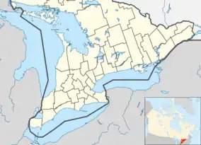
Orillia is a city in Central Ontario, Canada. It is 135 kilometers (84 miles) north of Toronto. It is between two lakes, Lake Couchiching and Lake Simcoe. According to the Canada 2011 Census, 30,586 people lived in Orillia.[4]
Orillia | |
|---|---|
| City of Orillia | |
 Waterfront of Orillia | |
 Flag  Logo | |
| Nickname: The Sunshine City | |
 Orillia  Orillia | |
| Coordinates: 44°36′15″N 79°25′26″W | |
| Country | Canada |
| Province | Ontario |
| Incorporation | 1867 (Village) |
| Incorporation | 1875 (Town) |
| Incorporation | 1969 (City) |
| Government | |
| • Mayor | Steve Clarke |
| Area | |
| • Land | 28.58 km2 (11.03 sq mi) |
| Elevation | 219.50 m (720.14 ft) |
| Population (2016)[3] | |
| • Total | 31,166 |
| • Density | 1,090.3/km2 (2,824/sq mi) |
| Time zone | UTC−05:00 (EST) |
| • Summer (DST) | UTC−04:00 (EDT) |
| Forward Sortation Area | L3V |
| Area code | 705 / 249 |
| Website | www |
The Orillia City Council is in charge of governing the city and has eight councilors and a mayor. The Ontario Provincial Police has its headquarters in the city.
The Huron and the Iroquois lived in the area of Orillia for over 4,000 years. Nobody really knows how Orillia got its name. It might come from the Spanish word "orilla", which means the shore of a lake or river. Orillia was incorporated as a village in 1867. It became a city in 1967.
References
- "Orillia (Census agglomeration) census profile". 2011 Census of Population. Statistics Canada. Archived from the original on 2013-07-18. Retrieved 2012-03-06.
- Environment Canada — Canadian Climate Normals 1971–2000, accessed 15 April 2012
- Canada, Government of Canada, Statistics. "Census Profile, 2016 Census Orillia, City and Province of Ontario". Retrieved July 8, 2019.
{{cite web}}: CS1 maint: multiple names: authors list (link) - "Orillia | Ontario, Canada". Encyclopedia Britannica. Retrieved 2021-06-25.
This article is issued from Wikipedia. The text is licensed under Creative Commons - Attribution - Sharealike. Additional terms may apply for the media files.