Neunkirchen am Brand
Neunkirchen am Brand is a municipality in the district of Forchheim in Bavaria in Germany.
Neunkirchen am Brand | |
|---|---|
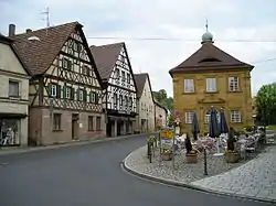 Center of Neunkirchen with timbered houses and the old deanery near St.-Michaels Church (right side of the image) | |
 Coat of arms | |
Location of Neunkirchen am Brand within Forchheim district  | |
 Neunkirchen am Brand  Neunkirchen am Brand | |
| Coordinates: 49°37′N 11°08′E | |
| Country | Germany |
| State | Bavaria |
| Admin. region | Oberfranken |
| District | Forchheim |
| Government | |
| • Mayor (2020–26) | Martin Walz[1] (CSU) |
| Area | |
| • Total | 26.37 km2 (10.18 sq mi) |
| Elevation | 317 m (1,040 ft) |
| Population (2022-12-31)[2] | |
| • Total | 8,131 |
| • Density | 310/km2 (800/sq mi) |
| Time zone | UTC+01:00 (CET) |
| • Summer (DST) | UTC+02:00 (CEST) |
| Postal codes | 91077 |
| Dialling codes | 09134 |
| Vehicle registration | FO |
| Website | www.neunkirchen-am-brand.de |
Districts
There are the following districts (pop. statistics as of December 31, 2006):
- Neunkirchen (5995 inhabitants)
- Baad (85 inhabitants)
- Ebersbach (250 inhabitants)
- Ermreuth (921 inhabitants)
- Großenbuch (575 inhabitants)
- Rödlas (149 inhabitants)
- Rosenbach (261 inhabitants)
- Gleisenhof (near Ermreuth) and Wellucken (7 inhabitants)
Furthermore, there the farms Vogelhof, Erleinhof and Saarmühle.
References
- Liste der ersten Bürgermeister/Oberbürgermeister in kreisangehörigen Gemeinden, Bayerisches Landesamt für Statistik, 15 July 2021.
- Genesis Online-Datenbank des Bayerischen Landesamtes für Statistik Tabelle 12411-003r Fortschreibung des Bevölkerungsstandes: Gemeinden, Stichtag (Einwohnerzahlen auf Grundlage des Zensus 2011) .
Other websites
Wikimedia Commons has media related to Neunkirchen am Brand.
Towns and municipalities in Forchheim (district) | ||
|---|---|---|
| Coat of Arms of Forchheim district | |
This article is issued from Wikipedia. The text is licensed under Creative Commons - Attribution - Sharealike. Additional terms may apply for the media files.