Mount Vernon, Virginia
Mount Vernon is a census-designated place (CDP) and unincorporated community in Fairfax County, Virginia, United States. Nearly 13,000 people lived here in 2020. All of this land was once part of George Washington's large plantation, Mount Vernon.
Mount Vernon, Virginia | |
|---|---|
 Mount Vernon post office (2009) | |
 Location of Mount Vernon in Fairfax County, Virginia | |
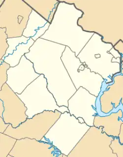 Mount Vernon, Virginia 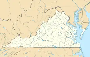 Mount Vernon, Virginia  Mount Vernon, Virginia | |
| Coordinates: 38°44′07″N 77°05′43″W | |
| Country | United States |
| State | Virginia |
| County | Fairfax |
| Named for | Mount Vernon |
| Area | |
| • Total | 6.07 sq mi (15.7 km2) |
| • Land | 5.24 sq mi (13.6 km2) |
| • Water | 0.83 sq mi (2.1 km2) |
| Elevation | 69 ft (24 m) |
| Population | |
| • Total | 12,914 |
| • Density | 2,100/sq mi (820/km2) |
| Time zone | UTC−5 (Eastern (EST)) |
| • Summer (DST) | UTC−4 (EDT) |
| ZIP code | 22309, 22121 |
| Area code(s) | 703, 571 |
| FIPS code | 51-54144[2] |
| GNIS feature ID | 2391234 |
References
- "QuickFacts: Mount Vernon CDP, Virginia". United States Census Bureau. Retrieved March 20, 2024.
- "U.S. Census website". United States Census Bureau. Retrieved 2008-01-31.
Municipalities and communities of Fairfax County, Virginia, United States | ||
|---|---|---|
| Towns |  Map of Virginia highlighting Fairfax County | |
| CDPs |
| |
| Unincorporated communities |
| |
| Ghost towns |
| |
This article is issued from Wikipedia. The text is licensed under Creative Commons - Attribution - Sharealike. Additional terms may apply for the media files.