Morrill, Kansas
Morrill is a city in Brown County, Kansas, United States. As of the 2020 census, 218 people lived there.[3]
Morrill, Kansas | |
|---|---|
 Location within Brown County and Kansas | |
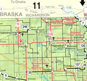 KDOT map of Brown County (legend) | |
| Coordinates: 39°55′45″N 95°41′40″W[1] | |
| Country | United States |
| State | Kansas |
| County | Brown |
| Founded | 1878 |
| Platted | 1878 |
| Incorporated | 1886 |
| Named for | Edmund Morrill |
| Area | |
| • Total | 0.20 sq mi (0.51 km2) |
| • Land | 0.20 sq mi (0.51 km2) |
| • Water | 0.00 sq mi (0.00 km2) |
| Elevation | 1,112 ft (339 m) |
| Population | |
| • Total | 218 |
| • Density | 1,100/sq mi (430/km2) |
| Time zone | UTC-6 (CST) |
| • Summer (DST) | UTC-5 (CDT) |
| ZIP code | 66515 |
| Area code | 785 |
| FIPS code | 20-48300 |
| GNIS ID | 2395406[1] |
History
Morrill was planned out in 1878 when the St. Joseph and Western Railroad was extended to that point.[4] It was named for Kansas governor Edmund Needham Morrill, the 13th Governor of Kansas.[5]
Geography
Morrill is at 39°55′45″N 95°41′40″W (39.929169, -95.694323).
According to the United States Census Bureau, the city has a total area of 0.20 square miles (0.52 km2). All of it is land.[2]
Demographics
| Historical population | |||
|---|---|---|---|
| Census | Pop. | %± | |
| 1890 | 308 | — | |
| 1900 | 400 | 29.9% | |
| 1910 | 398 | −0.5% | |
| 1920 | 552 | 38.7% | |
| 1930 | 519 | −6.0% | |
| 1940 | 387 | −25.4% | |
| 1950 | 362 | −6.5% | |
| 1960 | 299 | −17.4% | |
| 1970 | 308 | 3.0% | |
| 1980 | 336 | 9.1% | |
| 1990 | 299 | −11.0% | |
| 2000 | 277 | −7.4% | |
| 2010 | 230 | −17.0% | |
| 2020 | 218 | −5.2% | |
| U.S. Decennial Census | |||
2020 census
As of the 2020 census, there were 218 people, 78 households, and 51 families living in the city. Of the households, 85.9% owned their home and 14.1% rented their home.
The median age was 40.5 years. Of the people, 89.9% were White, 5.5% were Native American, and 4.6% were two or more races. Hispanic or Latino of any race were 1.8% of the people.[3][6]
Education
Morrill is served by USD 113 Prairie Hills.[8]
Morrill High School was closed through school unification. The Morrill High School mascot was Tigers.[9]
Notable people
- Howard Shultz Miller, former U.S. Representative from Kansas.[10]
References
- U.S. Geological Survey Geographic Names Information System: Morrill, Kansas
- "2020 U.S. Gazetteer Files". United States Census Bureau. Retrieved November 20, 2023.
- "DP1: PROFILE OF GENERAL POPULATION AND HOUSING CHARACTERISTICS". United States Census Bureau. Retrieved November 20, 2023.
- History of the State of Kansas: Containing a Full Account of Its Growth from an Uninhabited Territory to a Wealthy and Important State. A. T. Andreas. 1883. p. 740.
- Kansas Place-Names,John Rydjord, University of Oklahoma Press, 1972, p. 330 ISBN 0-8061-0994-7
- "P16: HOUSEHOLD TYPE". United States Census Bureau. Retrieved January 2, 2024.
- "American FactFinder". United States Census Bureau. Retrieved 2012-07-06.
- "Prairie Hills USD 113". USD 113. Retrieved 10 January 2017.
- "Morrill High School". E-YEARBOOK.COM. Retrieved 10 January 2017.
- "MILLER, Howard Shultz, (1879 - 1970)". Biographical Directory of the United States Congress. Retrieved October 14, 2012.
Other websites
- City
- Schools
- USD 113, local school district
- Maps
- Morrill City Map, KDOT
Municipalities and communities of Brown County, Kansas, United States | ||
|---|---|---|
| Cities |  Map of Kansas highlighting Brown County | |
| CDPs |
| |
| Unincorporated communities |
| |
| Indian reservations |
| |
| Townships |
| |
| Footnotes | ‡This populated place also has portions in an adjacent county or counties | |