Marion County, Indiana
Marion County is a county in the U.S. state of Indiana. As of the 2020 census, the county's population was 977,203.[1] The county seat is Indianapolis, the state capital and largest city.[2] Marion County and Indianapolis share the same government.
Marion County | |
|---|---|
_exterior.jpg.webp) City-County Building, Indianapolis | |
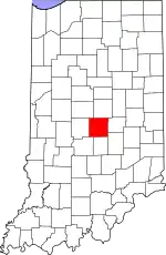 Location within the U.S. state of Indiana | |
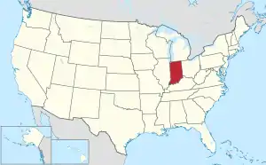 Indiana's location within the U.S. | |
| Coordinates: 39°47′N 86°08′W | |
| Country | |
| State | |
| Founded | April 1, 1822 |
| Named for | Francis Marion |
| Seat | Indianapolis |
| Largest city | Indianapolis |
| Area | |
| • Total | 403.01 sq mi (1,043.8 km2) |
| • Land | 396.30 sq mi (1,026.4 km2) |
| • Water | 6.71 sq mi (17.4 km2) |
| Population | |
| • Total | 977,203 |
| • Density | 2,466/sq mi (952/km2) |
| Time zone | UTC−5 (Eastern) |
| • Summer (DST) | UTC−4 (EDT) |
| Congressional districts | 6th, 7th |
| Website | www |
| |
Cities
Towns
- Clermont
- Crows Nest
- Cumberland
- Homecroft
- Meridian Hills
- N. Crows Nest
- Rocky Ripple
- Speedway
- Spring Hill
- Warren Park
- West Newton
- Williams Creek
- Wynnedale
References
- "QuickFacts: Marion County, Indiana". United States Census Bureau. Retrieved September 26, 2023.
- "Find a County". National Association of Counties. Retrieved October 21, 2015.
Municipalities and communities of Marion County, Indiana, United States | ||
|---|---|---|
| Excluded cities (Unigov) | ||
| Excluded town (Unigov) | ||
| Townships |
| |
| Included towns (Unigov) |
| |
| Footnotes | ‡ Part of Cumberland is in Hancock County. Only the portion in Marion County is subject to Unigov as an included town. | |
| Principal cities |  | |
|---|---|---|
| Municipalities with population over 20,000 (in 2020) |
| |
| Municipalities with population of 20,000–1,000 (in 2020) |
| |
| Municipalities with population under 1,000 (in 2020) |
| |
| Census-designated places |
| |
| Counties | ||
| Footnotes | ‡This populated place also has portions in counties outside of the MSA | |
This article is issued from Wikipedia. The text is licensed under Creative Commons - Attribution - Sharealike. Additional terms may apply for the media files.