Kincaid, Kansas
Kincaid is a city in Anderson County, Kansas, United States. In 2020, 103 people lived there.[3]
Kincaid, Kansas | |
|---|---|
 Location within Anderson County and Kansas | |
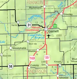 KDOT map of Anderson County (legend) | |
| Coordinates: 38°04′53″N 95°09′19″W[1] | |
| Country | United States |
| State | Kansas |
| County | Anderson |
| Founded | 1885 |
| Incorporated | 1886 |
| Named for | Robert Kincaid |
| Area | |
| • Total | 0.50 sq mi (1.30 km2) |
| • Land | 0.50 sq mi (1.30 km2) |
| • Water | 0.00 sq mi (0.00 km2) |
| Elevation | 1,043 ft (318 m) |
| Population | |
| • Total | 103 |
| • Density | 210/sq mi (79/km2) |
| Time zone | UTC-6 (CST) |
| • Summer (DST) | UTC-5 (CDT) |
| ZIP code | 66039 |
| Area code | 620 |
| FIPS code | 20-36875 |
| GNIS ID | 2395535[1] |
Geography
Kincaid is at 38°5′1″N 95°9′13″W (38.083502, -95.153612).[6] The United States Census Bureau says that the city has a total area of 0.50 square miles (1.29 km2). All of it is land.[2]
People
| Historical population | |||
|---|---|---|---|
| Census | Pop. | %± | |
| 1890 | 284 | — | |
| 1900 | 364 | 28.2% | |
| 1910 | 426 | 17.0% | |
| 1920 | 443 | 4.0% | |
| 1930 | 380 | −14.2% | |
| 1940 | 401 | 5.5% | |
| 1950 | 309 | −22.9% | |
| 1960 | 220 | −28.8% | |
| 1970 | 189 | −14.1% | |
| 1980 | 192 | 1.6% | |
| 1990 | 170 | −11.5% | |
| 2000 | 178 | 4.7% | |
| 2010 | 122 | −31.5% | |
| 2020 | 103 | −15.6% | |
| U.S. Decennial Census | |||
2020 census
The 2020 census says that there were 103 people, 46 households, and 28 families living in Kincaid. Of the households, 73.9% owned their home and 26.1% rented their home.
The median age was 42.3 years. Of the people, 91.3% were White, 2.9% were Black, 1.0% were Native American, and 4.9% were two or more races. None were Hispanic or Latino.[3][7]
Government
The Kincaid has a mayor and five council members. The council meets the 2nd Monday of each month at 7PM.[9]
- City Hall, 500 5th Ave.
Education
Kincaid is part of Unified School District 479.[10]
References
- U.S. Geological Survey Geographic Names Information System: Kincaid, Kansas
- "2020 U.S. Gazetteer Files". United States Census Bureau. Retrieved November 19, 2023.
- "DP1: PROFILE OF GENERAL POPULATION AND HOUSING CHARACTERISTICS". United States Census Bureau. Retrieved November 19, 2023.
- "County Towns". Anderson County Historical Society. Archived from the original on 8 June 2014. Retrieved 4 June 2014.
- Gannett, Henry (1905). The Origin of Certain Place Names in the United States. Govt. Print. Off. p. 175.
- "US Gazetteer files: 2010, 2000, and 1990". United States Census Bureau. 2011-02-12. Retrieved 2011-04-23.
- "P16: HOUSEHOLD TYPE". United States Census Bureau. Retrieved December 31, 2023.
- "American FactFinder". United States Census Bureau. Retrieved 2012-07-06.
- Kincaid - Directory of Public Officials
- USD 479
More reading
- The History Of Anderson County, Kansas, From Its First Settlement To The Fourth Of July, 1876; W.A. Johnson; Kauffman & Iler; 1877.[1]
- Plat Book Of Anderson County, Kansas, Compiled From County Records And Actual Survey; Northwest Publishing Co; 1901.[2]
- Kansas: A Cyclopedia Of State History, Embracing Events, Institutions, Industries, Counties, Cities, Towns, Prominent Persons, Etc; Frank W. Blackmar; Standard Publishing Co; 1912.[3][4][5]
- History Of The State of Kansas; William G. Cutler; A.T. Andreas Publisher; 1883.[6]
Other websites
- City
- Schools
- Historical
- Maps
- Kincaid City Map, KDOT
References
- The History Of Anderson County, Kansas, From Its First Settlement To The Fourth Of July, 1876; 1877.
- Plat Book Of Anderson County, Kansas, Compiled From County Records And Actual Survey; 1901.
- Kansas: A Cyclopedia Of State History, Embracing Events, Institutions, Industries, Counties, Cities, Towns, Prominent Persons, Etc - Vol 1; 1912.
- Kansas: A Cyclopedia Of State History, Embracing Events, Institutions, Industries, Counties, Cities, Towns, Prominent Persons, Etc - Vol 2; 1912.
- Kansas: A Cyclopedia Of State History, Embracing Events, Institutions, Industries, Counties, Cities, Towns, Prominent Persons, Etc - Vol 3; 1912.
- History Of The State of Kansas; 1883.
Municipalities and communities of Anderson County, Kansas, United States | ||
|---|---|---|
| Cities | 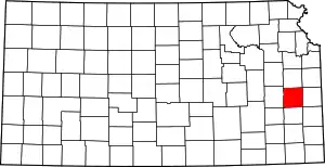 Map of Kansas highlighting Anderson County | |
| CDPs |
| |
| Unincorporated communities |
| |
| Ghost town |
| |
| Townships |
| |