Invercargill
Invercargill (Māori: Waihōpai)[2] is the southernmost and westernmost city in New Zealand, and one of the southernmost cities in the world. It is the commercial centre of the Southland region. It lies in the Southland Plains on the Oreti or New River some 18 km north of Bluff, which is the southernmost town in the South Island. It sits amid rich farmland that is bordered by large areas of conservation land and marine reserves, including Fiordland National Park covering the south-west corner of the South Island and the Catlins coastal region.
Invercargill
Waihōpai (Māori) | |
|---|---|
 Spring in Esk Street, Invercargill | |
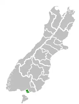 Invercargill City's location within the South Island | |
| Coordinates: 46°24′47″S 168°20′51″E | |
| Country | |
| Island | South Island |
| Region | Southland |
| Territorial authority | Invercargill City |
| Settled by Europeans | 1853 |
| Government | |
| • Mayor | Tim Shadbolt |
| • Deputy Mayor | Rebecca Amundsen |
| Area | |
| • Territorial | 389 km2 (150 sq mi) |
| • Urban | 115 km2 (44 sq mi) |
| Population (June 2017)[1] | |
| • Territorial | 54,800 |
| • Density | 140/km2 (360/sq mi) |
| • Urban | 50,800 |
| • Urban density | 440/km2 (1,100/sq mi) |
| Demonym | Invercargillite |
| Time zone | UTC+12 (NZST) |
| • Summer (DST) | UTC+13 (NZDT) |
| Postcode(s) | 9810, 9812 |
| Area code | 03 |
| Local iwi | Ngāi Tahu |
| Website | icc |
References
- "Subnational Population Estimates: At 30 June 2017 (provisional)". Statistics New Zealand. 24 October 2017. Retrieved 24 October 2017. For urban areas, "Subnational population estimates (UA, AU), by age and sex, at 30 June 1996, 2001, 2006-16 (2017 boundary)". Statistics New Zealand. 24 October 2017. Retrieved 24 October 2017.
- "List of Place Names – Māori Language Resources – Te Taura Whiri i te Reo Māori – Māori Language Commission". Archived from the original on 2015-06-09. Retrieved 2017-11-29.
This article is issued from Wikipedia. The text is licensed under Creative Commons - Attribution - Sharealike. Additional terms may apply for the media files.