Interstate 465
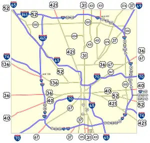
Interstate 465 (I-465), also known as the USS Indianapolis Memorial Highway, is the beltway circling Indianapolis, Indiana, United States. It has a perimeter of approximately 52.79 miles (84.96 km). It lies almost completely within the boundaries of Marion County. It intersects with I-65, I-69, I-70, and I-74, and provides additional access to I-65 via I-865.
I-465 | ||||
|---|---|---|---|---|
| USS Indianapolis Memorial Highway | ||||
 | ||||
| Route information | ||||
| Auxiliary route of I-65 | ||||
| Length | 52.79 mi[1] (84.96 km) | |||
| Existed | 1959 (completed 1970)–present | |||
| NHS | Entire route | |||
| Major junctions | ||||
| Beltway around Indianapolis, Indiana | ||||
| ||||
| Location | ||||
| Country | United States | |||
| State | Indiana | |||
| Counties | Boone, Hamilton, Marion | |||
| Highway system | ||||
| ||||
| ||||

References
- Reference Post Book (PDF). Indianapolis: Indiana Department of Transportation. 2004. I-465. Archived from the original (PDF) on June 15, 2011.
This article is issued from Wikipedia. The text is licensed under Creative Commons - Attribution - Sharealike. Additional terms may apply for the media files.