Hassel (Bergen)
Hassel is a village administered by the Lower Saxon town of Bergen in the northern part of Celle on the Lüneburg Heath in North Germany. Previously an independent municipality, it is part of the town Bergen since 1973.
Hassel | |
|---|---|
Ortsteil of Bergen | |
Location of Hassel | |
 Hassel 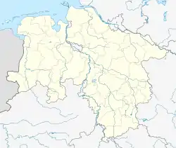 Hassel | |
| Coordinates: 52°44′06″N 09°59′22″E | |
| Country | Germany |
| State | Lower Saxony |
| District | Celle |
| Town | Bergen |
| Area | |
| • Total | 14.40 km2 (5.56 sq mi) |
| Population (2019)[1] | |
| • Total | 191 |
| • Density | 13/km2 (34/sq mi) |
| Time zone | UTC+01:00 (CET) |
| • Summer (DST) | UTC+02:00 (CEST) |
| Postal codes | 29303 |
| Dialling codes | 05054 |
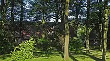
A Hassel farmstead beneath the ancient oaks
Geography
It is about 11 kilometres (6.8 mi) south of Bergen on the B 3 federal road in the glacial valley of the River Örtze. It has an area of 1,440 hectares (3,600 acres). It is administratively responsible for the neighbouring hamlets of Achterberg, Grünewald and Wallerholz.
Footnotes and references
- "Zahlen, Daten, Fakten". Stadt Bergen. Retrieved 25 September 2021.
Literature
- Schützenverein Hassel (Hrsg.) - 75 Jahre Schützenverein Hassel, 1924–1999
This article is issued from Wikipedia. The text is licensed under Creative Commons - Attribution - Sharealike. Additional terms may apply for the media files.