Greenville County, South Carolina
Greenville County is a county in the state of South Carolina, United States. As of the 2020 census, 525,534 people lived there.[1] It is the most populous county in the state. It is a part of the Greenville-Anderson-Mauldin Metropolitan Statistical Area. Its county seat is the city of Greenville.[2]
Greenville County | |
|---|---|
 Old Greenville County Courthouse | |
|
Logo | |
| Motto: "Unrivaled Quality Of Life" | |
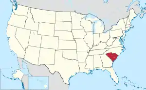
 Location within the U.S. state of South Carolina | |
 South Carolina's location within the U.S. | |
| Coordinates: 34°53′N 82°22′W | |
| Country | |
| State | |
| Founded | 1786 |
| Named for | Nathanael Greene |
| Seat | Greenville |
| Largest community | Greenville |
| Area | |
| • Total | 795.57 sq mi (2,060.5 km2) |
| • Land | 785.93 sq mi (2,035.5 km2) |
| • Water | 9.64 sq mi (25.0 km2) 1.21% |
| Population (2020) | |
| • Total | 525,534 |
| • Density | 668.68/sq mi (258.18/km2) |
| Time zone | UTC−5 (Eastern) |
| • Summer (DST) | UTC−4 (EDT) |
| Congressional districts | 3rd, 4th |
| Website | www |
Geography
| Historical population | |||
|---|---|---|---|
| Census | Pop. | %± | |
| 1790 | 6,503 | — | |
| 1800 | 11,504 | 76.9% | |
| 1810 | 13,133 | 14.2% | |
| 1820 | 14,530 | 10.6% | |
| 1830 | 16,476 | 13.4% | |
| 1840 | 17,839 | 8.3% | |
| 1850 | 20,156 | 13.0% | |
| 1860 | 21,892 | 8.6% | |
| 1870 | 22,262 | 1.7% | |
| 1880 | 37,496 | 68.4% | |
| 1890 | 44,310 | 18.2% | |
| 1900 | 53,490 | 20.7% | |
| 1910 | 68,377 | 27.8% | |
| 1920 | 88,498 | 29.4% | |
| 1930 | 117,009 | 32.2% | |
| 1940 | 136,580 | 16.7% | |
| 1950 | 168,152 | 23.1% | |
| 1960 | 209,776 | 24.8% | |
| 1970 | 240,546 | 14.7% | |
| 1980 | 287,913 | 19.7% | |
| 1990 | 320,167 | 11.2% | |
| 2000 | 379,616 | 18.6% | |
| 2010 | 451,225 | 18.9% | |
| 2020 | 525,534 | 16.5% | |
| U.S. Decennial Census[3] 1790–1960[4] 1900–1990[5] 1990–2000[6] 2010–2020[1] | |||
The county has a total area of 795 square miles (2,059.0 km2). Of this, 790 square miles (2,046.1 km2) is land and 5 square miles (12.9 km2) (0.61%) is water.[7]
Adjacent counties
- Henderson County, North Carolina - north
- Polk County, North Carolina - northeast
- Spartanburg County, South Carolina - east
- Laurens County, South Carolina - southeast
- Abbeville County, South Carolina - south
- Anderson County, South Carolina - southwest
- Pickens County, South Carolina - west
- Transylvania County, North Carolina - northwest
Communities
The 2010 Census lists six cities and 16 census designated places in Greenville County.[8]
Cities
| City | Population | Also in |
|---|---|---|
| Greenville | 60,379 | |
| Greer | 26,002 | Spartanburg County |
| Mauldin | 23,408 | |
| Simpsonville | 18,652 | |
| Fountain Inn | 7,937 | Laurens County |
| Travelers Rest | 4,680 | |
| 2011 estimate population[9] | ||
Unincorporated communities
| Community | Population | Also in |
|---|---|---|
| Taylors | 21,617 | |
| Wade Hampton | 20,622 | |
| Berea | 14,295 | |
| Gantt | 14,229 | |
| - Five Forks | 14,140 | |
| Parker | 11,431 | |
| Sans Souci | 7,869 | |
| Welcome | 6,668 | |
| Piedmont | 5,103 | Anderson County |
| Dunean | 3,671 | |
| Golden Grove | 2,467 | |
| Slater-Marietta | 2,176 | |
| Judson | 2,050 | |
| City View | 1,345 | |
| Tigerville | 1,312 | |
| Ware Place | 228 |
References
- "QuickFacts: Greenville County, South Carolina". United States Census Bureau. Retrieved January 20, 2024.
- "Find a County". National Association of Counties. Retrieved 2008-01-31.
- "U.S. Decennial Census". United States Census Bureau. Retrieved March 17, 2015.
- "Historical Census Browser". University of Virginia Library. Archived from the original on August 11, 2012. Retrieved March 17, 2015.
- Forstall, Richard L., ed. (March 27, 1995). "Population of Counties by Decennial Census: 1900 to 1990". United States Census Bureau. Retrieved March 17, 2015.
- "Census 2000 PHC-T-4. Ranking Tables for Counties: 1990 and 2000" (PDF). United States Census Bureau. April 2, 2001. Archived (PDF) from the original on 2022-10-09. Retrieved March 17, 2015.
- "US Gazetteer files: 2000 and 1990". United States Census Bureau. 2005-05-03. Retrieved 2008-01-31.
- See http://factfinder2.census.gov for population numbers and for municipality and CDP lists in the 2010 Census.
- "Annual Estimates of the Population for Incorporated Places in North Dakota". United States Census Bureau. 2013-03-30. Retrieved 2013-03-30.
Places next to Greenville County, South Carolina | |
|---|---|
Other websites
This article is issued from Wikipedia. The text is licensed under Creative Commons - Attribution - Sharealike. Additional terms may apply for the media files.