Grayson County, Kentucky
Grayson County is a county in the U.S. state of Kentucky. As of the 2020 census, the population was 26,420.[1] Its county seat is Leitchfield.[2]
Grayson County | |
|---|---|
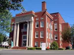 Grayson County courthouse in Leitchfield | |
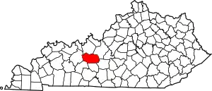 Location within the U.S. state of Kentucky | |
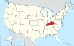 Kentucky's location within the U.S. | |
| Coordinates: 37°28′N 86°21′W | |
| Country | |
| State | |
| Founded | 1810 |
| Named for | William Grayson |
| Seat | Leitchfield |
| Largest city | Leitchfield |
| Area | |
| • Total | 511 sq mi (1,320 km2) |
| • Land | 497 sq mi (1,290 km2) |
| • Water | 14 sq mi (40 km2) 2.8% |
| Population (2020) | |
| • Total | 26,420 |
| • Density | 52/sq mi (20/km2) |
| Time zone | UTC−6 (Central) |
| • Summer (DST) | UTC−5 (CDT) |
| Congressional district | 2nd |
| Website | graysoncountyky |
History
Grayson County was formed in 1810 from land taken from Hardin and Ohio counties.[3] The county is named for William Grayson (1740-1790), a Revolutionary War colonel and U.S. Senator from Virginia.[4]
Geography
The county has a total area of 511 square miles (1,320 km2).[5]
Bordering counties
- Breckinridge County (north)
- Hardin County (northeast/EST Border)
- Hart County (southeast)
- Edmonson County (south)
- Butler County (southwest)
- Ohio County (west)
Communities
Cities
- Caneyville
- Clarkson
- Leitchfield (county seat)
Census-designated place
- Big Clifty
Other unincorporated places
- Anneta, Kentucky
- Pine Knob
- Saint Paul
References
- "QuickFacts: Grayson County, Kentucky". United States Census Bureau. Retrieved October 4, 2023.
- "Find a County". National Association of Counties. Archived from the original on 2011-05-31. Retrieved 2011-06-07.
- Collins, Lewis (1877). History of Kentucky. p. 293. ISBN 9780722249208.
- The Register of the Kentucky State Historical Society, Volume 1. Kentucky State Historical Society. 1903. p. 35.
- "2010 Census Gazetteer Files". United States Census Bureau. August 22, 2012. Archived from the original on August 12, 2014. Retrieved August 14, 2014.
Municipalities and communities of Grayson County, Kentucky, United States | ||
|---|---|---|
| Cities | Location of Grayson County, Kentucky | |
| CDP |
| |
| Other unincorporated communities |
| |
This article is issued from Wikipedia. The text is licensed under Creative Commons - Attribution - Sharealike. Additional terms may apply for the media files.