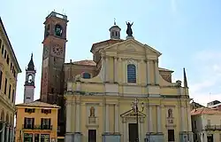
Garlasco
Garlasco is a comune in the Province of Pavia in the Lombardy region in Italy. It is about 35 kilometres (22 mi) southwest of Milan and about 20 kilometres (12 mi) west of Pavia. As of 31 December 2004, 9,343 people lived there. It has an area of 39.0 square kilometres (15.1 sq mi).[3]
Garlasco | |
|---|---|
| Comune di Garlasco | |
 | |
Location of Garlasco | |
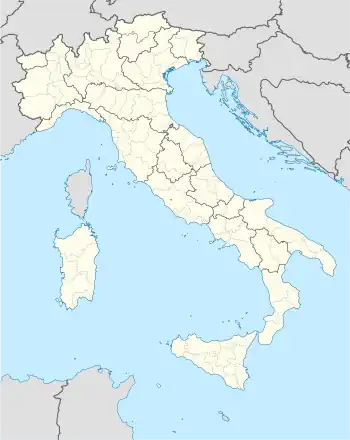 Garlasco Location of Garlasco in Italy 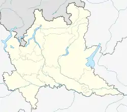 Garlasco Garlasco (Lombardy) | |
| Coordinates: 45°12′N 8°55′E | |
| Country | Italy |
| Region | Lombardy |
| Province | Pavia (PV) |
| Frazioni | Bozzola |
| Area | |
| • Total | 39.0 km2 (15.1 sq mi) |
| Elevation | 93 m (305 ft) |
| Population (Dec. 2004)[2] | |
| • Total | 9,343 |
| • Density | 240/km2 (620/sq mi) |
| Demonym | Garlaschesi |
| Time zone | UTC+1 (CET) |
| • Summer (DST) | UTC+2 (CEST) |
| Postal code | 27026 |
| Dialing code | 0382 |
| Website | Official website |
The municipality has only frazione Bozzola.
Garlasco is next to these municipalities: Alagna, Borgo San Siro, Dorno, Gropello Cairoli, Tromello, Zerbolò.
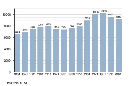
Demographic change
References
- "Superficie di Comuni Province e Regioni italiane al 9 ottobre 2011". Italian National Institute of Statistics. Retrieved 16 March 2019.
- "Popolazione Residente al 1° Gennaio 2018". Italian National Institute of Statistics. Retrieved 16 March 2019.
- All demographics and other statistics: Italian statistical institute Istat.
This article is issued from Wikipedia. The text is licensed under Creative Commons - Attribution - Sharealike. Additional terms may apply for the media files.