Doetinchem
Doetinchem (Achterhooks: Deutekem in the city or Dörkum in the region) is a municipality and city in the province of Gelderland, the Netherlands. About 58,000 people were living there in 2021.
Doetinchem
Deutekem / Dörkum | |
|---|---|
Municipality, city | |
 | |
 Flag  Coat of arms | |
.svg.png.webp) Location | |
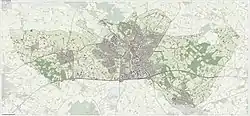 Map | |
| Coordinates: 51°58′N 6°17′E | |
| Country | Netherlands |
| Province | Gelderland |
| Region | Achterhoek, Liemers |
| Government | |
| • Body | Municipal council |
| • Mayor | Mark Boumans (VVD) |
| Area | |
| • Total | 79.66 km2 (30.76 sq mi) |
| • Land | 79.05 km2 (30.52 sq mi) |
| • Water | 0.61 km2 (0.24 sq mi) |
| Elevation | 14 m (46 ft) |
| Population (2019)[4] | |
| • Total | 57,555 |
| • Density | 728/km2 (1,890/sq mi) |
| Demonym | Doetinchemmer |
| Time zone | UTC+1 (CET) |
| • Summer (DST) | UTC+2 (CEST) |
| Postcode | 7001–7009, 7011, 7031 |
| Area code | 0314, 0315 |
| Website | www |
The city lies in the Achterhoek region. The Oude IJssel river flows through Doetinchem.
It got city rights in 1236.
The former municipality of Wehl joined Doetinchem in 2005.
References
- "Samenstelling college". Gemeente Doetinchem (in Dutch). Retrieved 10 February 2022.
- "Kerncijfers wijken en buurten 2020" [Key figures for neighbourhoods 2020]. StatLine (in Dutch). CBS. 24 July 2020. Retrieved 19 September 2020.
- "Postcodetool". Actueel Hoogtebestand Nederland (in Dutch). Retrieved 10 February 2022.
- "Bevolkingsontwikkeling; regio per maand" [Population growth; regions per month]. CBS Statline (in Dutch). CBS. 1 January 2019. Retrieved 1 January 2019.
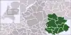
Places next to Doetinchem | |
|---|---|

Municipalities of Achterhoek (10) | ||
|---|---|---|
 | ||
This article is issued from Wikipedia. The text is licensed under Creative Commons - Attribution - Sharealike. Additional terms may apply for the media files.