Dixie County, Florida
Dixie County is a county in the U.S. state of Florida. As of 2020, 16,759 people lived there.[1] Its county seat is Cross City, Florida[2].
Dixie County | |
|---|---|
 Seal | |
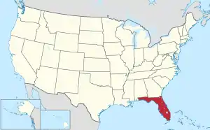
 Location within the U.S. state of Florida | |
 Florida's location within the U.S. | |
| Coordinates: 29°35′N 83°11′W | |
| Country | |
| State | |
| Founded | April 25, 1921 |
| Named for | Dixieland |
| Seat | Cross City |
| Largest town | Cross City |
| Area | |
| • Total | 864 sq mi (2,240 km2) |
| • Land | 705 sq mi (1,830 km2) |
| • Water | 159 sq mi (410 km2) 18.4% |
| Population | |
| • Total | 16,759 |
| • Density | 24/sq mi (9/km2) |
| Time zone | UTC−5 (Eastern) |
| • Summer (DST) | UTC−4 (EDT) |
| Website | dixie |
History
Dixie County was created in 1921 from the southern portion of Lafayette County. "Dixie" is a common nickname for the Southern United States.
Land
According to the U.S. Census Bureau, the county has a total area of 864 square miles (2,240 km2), of which 705 square miles (1,830 km2) is land and 159 square miles (410 km2) (18.4%) is water.[3]
Counties nearby
- Taylor County, Florida - northwest
- Lafayette County, Florida - north
- Gilchrist County, Florida - east
- Levy County, Florida - southeast
National protected area
- Lower Suwannee National Wildlife Refuge (part)
People
At the 2020 census, 16,759 people lived in the county. There were 6,248 households and 1,876 people who did not live in households. The population density was 23.8 people per square mile (9.2/km²). The median age was 47.5 years (45.6 for males, 49.9 for females).
Of the total population, 18.1% were under 18 years old, 58.8% were 18 to 64, and 23.2% were 65 or over. Males made up 55.6% and females made up 44.4% of the people. The population was 82.0% White (non-Latino), 9.3% Black (non-Latino), 4.1% Hispanic or Latino, and 3.7% Two or more races (non-Latino). Less than 1% of the people were from other races.
Of the 6,248 households, 3,905 (62.5%) were families, 1,545 (24.7%) had children under 18, 2,706 (43.3%) had a married couple, and 1,868 (29.9%) had one person living alone. The average household size was 2.4 people. There were 9,276 housing units, and 67.4% had people living in them all year, while 21.5% were for seasonal use (part of the year). Of the households, 79.7% were owner-occupied, while 20.3% were renters.[4][5]
As of 2022, the median (middle) yearly income for a household was about $45,057, and the median income for a family was about $49,404.[6] The per capita income was about $20,508.[7] About 9.6% of families[8] and 16.1% of all people in Dixie County lived below the poverty line. This includes 25.8% of children under 18 years old and 11.6% of people over 65 years old.[9]
Cities and towns
- Cross City
- Horseshoe Beach
Unincorporated
- Clara (shared with Taylor County)
- Eugene
- Hines
- Jonesboro
- Old Town
- Shamrock Noted for its turpentine industry in the 1930s and 40s.
- Shired Island Noted for topping the list of America's most polluted beaches in 2008.
- Suwannee
- Yellow Jacket
Politics
In Presidential elections, Dixie County tends to vote Republican, although both Democrat Bill Clinton and Reform Party candidate Ross Perot did very well in 1992 and 1996. During the 21st century, the county has become increasingly Republican.
| Year | Republican | Democratic | Third party | |||
|---|---|---|---|---|---|---|
| No. | % | No. | % | No. | % | |
| 2020 | 6,759 | 82.70% | 1,365 | 16.70% | 49 | 0.60% |
| 2016 | 5,822 | 80.35% | 1,270 | 17.53% | 154 | 2.13% |
| 2012 | 5,052 | 72.60% | 1,798 | 25.84% | 109 | 1.57% |
| 2008 | 5,194 | 71.22% | 1,925 | 26.40% | 174 | 2.39% |
| 2004 | 4,434 | 68.83% | 1,960 | 30.43% | 48 | 0.75% |
| 2000 | 2,697 | 57.79% | 1,827 | 39.15% | 143 | 3.06% |
| 1996 | 1,399 | 36.82% | 1,734 | 45.63% | 667 | 17.55% |
| 1992 | 1,401 | 32.04% | 1,855 | 42.42% | 1,117 | 25.54% |
| 1988 | 2,031 | 59.79% | 1,366 | 40.21% | 0 | 0.00% |
| 1984 | 2,204 | 64.29% | 1,224 | 35.71% | 0 | 0.00% |
| 1980 | 1,101 | 34.70% | 2,010 | 63.35% | 62 | 1.95% |
| 1976 | 558 | 20.28% | 2,169 | 78.82% | 25 | 0.91% |
| 1972 | 1,628 | 81.52% | 367 | 18.38% | 2 | 0.10% |
| 1968 | 217 | 10.39% | 325 | 15.57% | 1,546 | 74.04% |
| 1964 | 908 | 49.59% | 923 | 50.41% | 0 | 0.00% |
| 1960 | 392 | 28.65% | 976 | 71.35% | 0 | 0.00% |
| 1956 | 370 | 29.04% | 904 | 70.96% | 0 | 0.00% |
| 1952 | 440 | 34.81% | 824 | 65.19% | 0 | 0.00% |
| 1948 | 111 | 8.73% | 862 | 67.82% | 298 | 23.45% |
| 1944 | 84 | 7.07% | 1,104 | 92.93% | 0 | 0.00% |
| 1940 | 84 | 5.59% | 1,420 | 94.41% | 0 | 0.00% |
| 1936 | 64 | 5.19% | 1,170 | 94.81% | 0 | 0.00% |
| 1932 | 55 | 4.78% | 1,096 | 95.22% | 0 | 0.00% |
| 1928 | 463 | 57.52% | 342 | 42.48% | 0 | 0.00% |
| 1924 | 14 | 5.13% | 257 | 94.14% | 2 | 0.73% |
Points of interest
- City Of Hawkinsville - sunken steamboat in the Suwannee River near Old Town, one of the Florida Underwater Archaeological Preserves
- Old Town Elementary School, now the Dixie County Cultural Center
- Old Town Methodist Church built in 1890 behind the 1983 church building.
References
- "QuickFacts: Dixie County, Florida". United States Census Bureau. Retrieved August 10, 2023.
- "Find a County". National Association of Counties. Retrieved 2008-01-31.
- "US Gazetteer files: 2010, 2000, and 1990". United States Census Bureau. February 12, 2011. Retrieved April 23, 2011.
- "DP1: PROFILE OF GENERAL POPULATION AND HOUSING CHARACTERISTICS". United States Census Bureau. Retrieved May 1, 2024.
- "P16: HOUSEHOLD TYPE". United States Census Bureau. Retrieved May 1, 2024.
- "S1901: Income in the Past 12 Months (in 2022 Inflation-Adjusted Dollars)". United States Census Bureau. Retrieved May 1, 2024.
- "S1902: Mean Income in the Past 12 Months (in 2022 Inflation-Adjusted Dollars)". United States Census Bureau. Retrieved May 1, 2024.
- "S1702: Poverty Status in the Past 12 Months of Families". United States Census Bureau. Retrieved May 1, 2024.
- "S1701: Poverty Status in the Past 12 Months". United States Census Bureau. Retrieved May 1, 2024.
- Leip, David. "Dave Leip's Atlas of U.S. Presidential Elections". uselectionatlas.org.
Other websites
- Dixie County Advocate, local newspaper available in full-text for free from the Florida Digital Newspaper Library
- Dixie County Times, A recently started local newspaper managed by the former editor of the Dixie County Advocate.
- WZCC-AM 1240, Cross City's Community Radio Station.
Government links/Constitutional offices
- Dixie County Board of County Commissioners
- Dixie County Supervisor of Elections Archived 2007-08-17 at the Wayback Machine
- Dixie County Property Appraiser Archived 2010-04-16 at the Wayback Machine
- Dixie County Sheriff's Office
- Dixie County Tax Collector
Special districts
- Dixie County Schools Archived 2011-05-14 at the Wayback Machine
- Suwannee River Water Management District
Judicial branch
- Dixie County Clerk of Courts Archived 2011-05-14 at the Wayback Machine
- Public Defender, 3rd Judicial Circuit of Florida serving Columbia, Dixie, Hamilton, Lafayette, Madison, Suwannee, and Taylor Counties
- Office of the State Attorney, 3rd Judicial Circuit of Florida
- Circuit and County Court for the 3rd Judicial Circuit of Florida
Tourism links
- Dixie County Chamber of Commerce Archived 2007-03-13 at the Wayback Machine