Division of Cunningham
The Division of Cunningham is an Australian electoral division in New South Wales. It was set up in 1949 and is named for Allan Cunningham, a 19th century explorer of New South Wales and Queensland.[1]
| Cunningham Australian House of Representatives Division | |
|---|---|
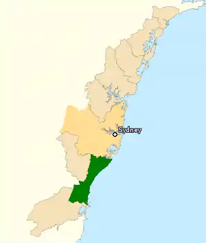
 Division of Cunningham (green) in New South Wales | |
| Created | 1949 |
| MP | Alison Byrnes |
| Party | Labor |
| Namesake | Allan Cunningham |
| Electors | 100,643 (2010) |
| Area | 721 km2 (278.4 sq mi) |
| Demographic | Provincial |

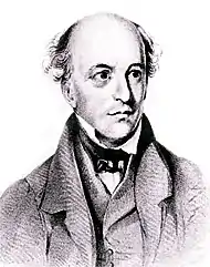
Allan Cunningham
It is on the coast of New South Wales and includes parts of the city of Wollongong, Corrimal, Figtree and Unanderra. It also includes several suburbs of Sydney, including Heathcote and Bundeena.
Members
| Member | Party | Years | |
|---|---|---|---|
| Billy Davies | Labor | 1949–1956 | |
| Victor Kearney | Labor | 1956–1963 | |
| Rex Connor | Labor | 1963–1977 | |
| Stewart West | Labor | 1977–1993 | |
| Stephen Martin | Labor | 1993–2002 | |
| Michael Organ | Greens | 2002–2004 | |
| Sharon Bird | Labor | 2004–present | |
Rex Connor was the Minister for Minerals and Energy in the Whitlam government. Stephen Martin was Speaker of the House of Representatives from 1993-1996. Sharon Bird held several ministerial positions in the Gillard and Rudd governments.
Election results
| 2022 Australian federal election: Cunningham[2] | |||||
|---|---|---|---|---|---|
| Party | Candidate | Votes | % | ±% | |
| Labor | Alison Byrnes | 40,783 | 40.11 | −6.50 | |
| Liberal | Marcus Uren | 25,418 | 25.00 | −5.97 | |
| Greens | Dylan Green | 22,011 | 21.65 | +6.56 | |
| One Nation | Thomas Grogan | 5,218 | 5.13 | +5.13 | |
| United Australia | Ben Britton | 4,936 | 4.85 | +1.05 | |
| Liberal Democrats | Michael Glover | 2,207 | 2.17 | +2.17 | |
| Australian Citizens | Alexis Garnaut-Miller | 1,098 | 1.08 | +1.08 | |
| Total formal votes | 101,671 | 94.86 | +0.56 | ||
| Informal votes | 5,514 | 5.14 | −0.56 | ||
| Turnout | 107,185 | 91.48 | −1.17 | ||
| Two-party-preferred result | |||||
| Labor | Alison Byrnes | 65,783 | 64.70 | +1.29 | |
| Liberal | Marcus Uren | 35,888 | 35.30 | −1.29 | |
| Labor hold | Swing | +1.29 | |||
References
- "Profile of the electoral division of Cunningham (NSW)". Australian Electoral Commission. 2013. Retrieved 6 November 2013.
- Cunningham, NSW, 2022 Tally Room, Australian Electoral Commission.
- Wilson, Peter (2002). The Australian Political Almanack.
This article is issued from Wikipedia. The text is licensed under Creative Commons - Attribution - Sharealike. Additional terms may apply for the media files.