Dietenhofen
Dietenhofen is a municipality in Ansbach in Bavaria, Germany.
Dietenhofen | |
|---|---|
_003.jpg.webp) Dietenhofen Palace, seat of the local history museum | |
 Coat of arms | |
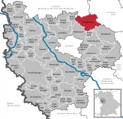
Location of Dietenhofen within Ansbach district  | |
 Dietenhofen  Dietenhofen | |
| Coordinates: 49°24′10″N 10°41′10″E | |
| Country | Germany |
| State | Bavaria |
| Admin. region | Middle Franconia |
| District | Ansbach |
| Government | |
| • Mayor (2020–26) | Rainer Erdel[1] |
| Area | |
| • Total | 63.96 km2 (24.70 sq mi) |
| Elevation | 353 m (1,158 ft) |
| Population (2022-12-31)[2] | |
| • Total | 5,716 |
| • Density | 89/km2 (230/sq mi) |
| Time zone | UTC+01:00 (CET) |
| • Summer (DST) | UTC+02:00 (CEST) |
| Postal codes | 90599 |
| Dialling codes | 09824 |
| Vehicle registration | AN |
| Website | www.dietenhofen.de |
Geography
This small village is in the Franconian Heights about 28 km west of Nuremberg, 14 km north east of Ansbach and 38 km east of Rothenburg o.d. Tauber.
The river Bibert flows through the valley community. It also gives its name to the Bibert walking and bicycle path. Apart from the main village, there are 27 subdivisions which also belong to Dietenhofen.
These are:
|
|
Political situation
The current mayor, Heinz Henninger has been in power since 1984.
The local council includes 20 voluntary members.
|
Dietenhofen has two twin towns: |
|
Exchanges take place and lasting friendships have been established.
Culture
Dietenhofen has a recently renovated indoor swimming pool and a sports hall. There are also some playing fields.
The clubs and music groups on offer make sure that there is something for everybody. Cultural events take place regularly.
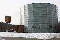
 St. Boniface’s – the new Catholic church, consecrated Sept. 2009
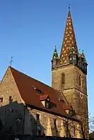
 St. Andrews – the Protestant church
References
- Liste der ersten Bürgermeister/Oberbürgermeister in kreisangehörigen Gemeinden, Bayerisches Landesamt für Statistik, 15 July 2021.
- Genesis Online-Datenbank des Bayerischen Landesamtes für Statistik Tabelle 12411-003r Fortschreibung des Bevölkerungsstandes: Gemeinden, Stichtag (Einwohnerzahlen auf Grundlage des Zensus 2011) .