Detroit River
The Detroit River is a river in the Great Lakes system.[1] The river connects Lake St. Clair to Lake Erie. It forms part of the border between Canada and the United States. It is 24 nautical miles (44 km; 28 mi) long.[2] It divides the cities of Detroit and Windsor. It is one of the busiest waterways in the world.[3]
| Detroit River Rivière Détroit | |
|---|---|
.jpg.webp) Southern end as it enters Lake Erie with Canada in the foreground and the U.S. in the background | |
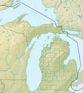 Location within the state of Michigan 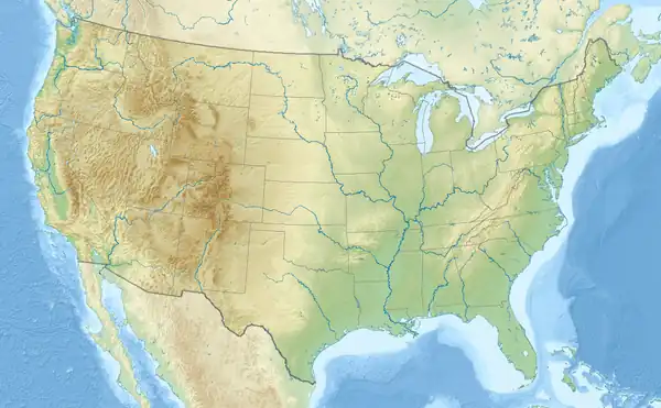 Location within the United States | |
| Location | |
| Country | United States, Canada |
| State | Michigan |
| Province | Ontario |
| Cities | US: Grosse Pointe Park, Detroit, River Rouge, Ecorse, Wyandotte, Riverview, Trenton, Gibraltar Canada: Tecumseh, Windsor, La Salle, Amherstburg |
| Physical characteristics | |
| Source | Lake St. Clair |
| - coordinates | 42°21′07″N 82°55′03″W |
| - elevation | 574 ft (175 m) |
| Mouth | Lake Erie |
| - coordinates | 42°03′06″N 83°09′05″W |
| - elevation | 571 ft (174 m) |
| Length | 28 mi (45 km) |
| Basin size | 700 sq mi (1,800 km2) |
| Basin features | |
| Tributaries | |
| - left | Little River, River Canard |
| - right | River Rouge, Ecorse River |
| Islands | 31 (list of islands) |
The name comes from the French Rivière du Détroit, which means River of the Strait.
References
- Environmental Protection Agency (29 April 2009). "Detroit River Area of Concern". Retrieved June 16, 2009.
- U.S. Geological Survey. National Hydrography Dataset high-resolution flowline data. The National Map Archived 2017-08-23 at the Wayback Machine, accessed November 7, 2011
- Nolan, Jenny (11 February 1997). "How the Detroit River shaped lives and history". The Detroit News. Detroit, Michigan. Archived from the original on 10 July 2012. Retrieved June 15, 2009.
| Topics |
| .jpg.webp) |
|---|---|---|
| Detroit |
| |
| Municipalities over 80,000 |
| |
| Municipalities 40,000 to 80,000 | ||
| Cultural enclaves |
| |
| Satellite cities | ||
| Counties in MSA | ||
| Counties in CSA | ||
| ||
American Heritage Rivers | ||
|---|---|---|
| Rivers |
| |
This article is issued from Wikipedia. The text is licensed under Creative Commons - Attribution - Sharealike. Additional terms may apply for the media files.