County Donegal
Donegal is a county in Ulster, Ireland. It is north of Leitrim and east of Northern Ireland.
County Donegal
Irish: Contae Dhún na nGall / Contae Thír Chonaill Coontie Dunnygal / Coontie Dinnygal | |
|---|---|
 Coat of arms | |
| Motto(s): | |
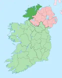 Location in Ireland | |
| Coordinates: 54.917°N 8.000°W | |
| Country | Ireland |
| Province | Ulster |
| Dáil Éireann | Donegal North–East, Donegal South–West |
| County seat | Lifford |
| Government | |
| • Type | County Council |
| Area | |
| • Total | 4,841 km2 (1,869 sq mi) |
| • Rank | (4th) |
| Population (2011) | 160,927 |
| • Rank | (10th) |
| Code | DL |
| Website | www |
| Coontie Dunnygal[1][2] and Coontie Dinnygal[3] are Ulster Scots spellings. | |
References
This article is issued from Wikipedia. The text is licensed under Creative Commons - Attribution - Sharealike. Additional terms may apply for the media files.